Dolly Sods Circumnavigation - mod1

U-Tube Video by Blaine Martin


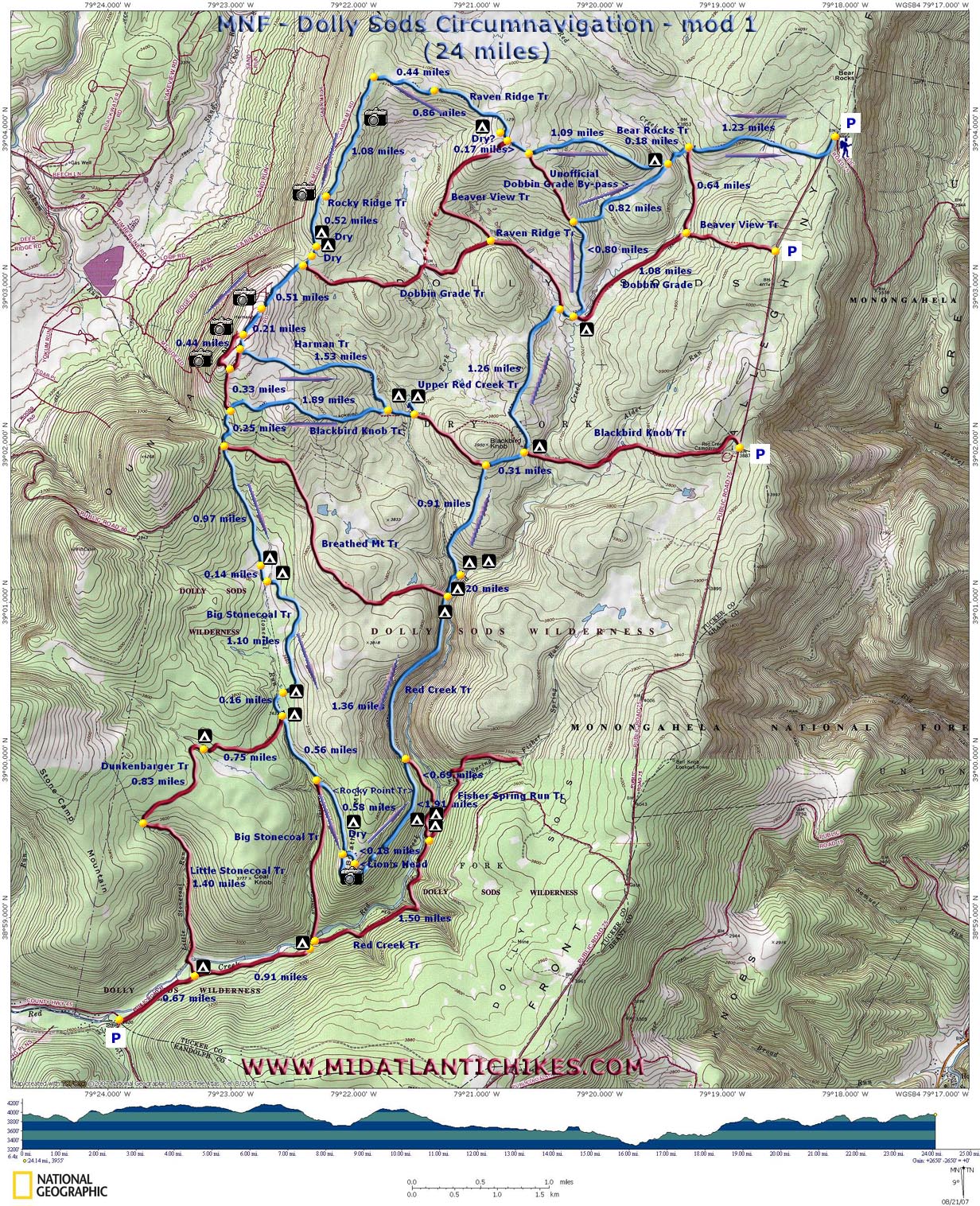
Description: This is a 24 mile modification of the Dolly Sods Circumnavigation found on this site. It differs by:

  1. Adding a few sections of new trails while subtracting others.

  2. Making the optional trip to the Lion's Head a part of the main loop and not a side bar out-and-back.

  3. Adding a new secluded campsite for the first night.

  4. Eliminating 3 major crossings of Red Creek (Something to consider when hiking this marvelous place when water levels are high.) as well as a few hundred feet of elevation change.

  5. Providing an un-official by-pass route eliminating the perpetually wet slog up Dobbin Grade.


Most of the original route is shown on the provided map, giving the hiker the ability to mix and match the trails.

Google Custom Directions

As you reach the top of the mountain the large trees will disappear and the road will make a final sharp left-hand turn. Park here on either side of the road. The Bear Rocks trailhead is about 100 yards further down the road. There is limited parking there but these spots are often full. 

________________________________________


Printable/Downloadable Map (11X17 Best)

View 3-D Map

Zipped National Geographic. TOPO! GPS and Universal GPX Files

GPS Text File for Non-TOPO! Users


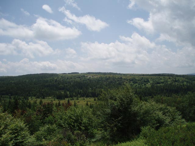
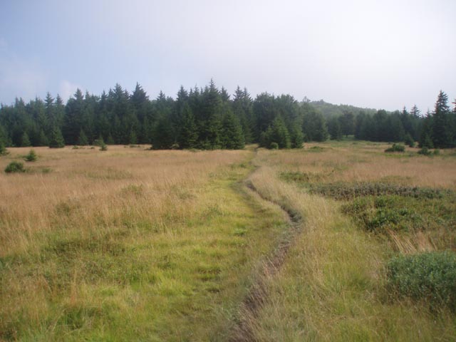
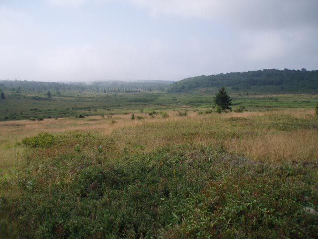
Trail Notes: There are no blazes in either Dolly Sods North or Dolly Sods Wilderness. Most of the trail junctions are signed in DSN but signs seem to come and go in the Wilderness area. 

Day 1: From the cars walk south on FR75 for about 100 yards and turn right onto an old jeep trail named Bear Rocks Trail (Tr522) and blocked by boulders. You will gradually descend to Dobbin Grade, passing a seriously eroded section of the jeep trail (A footpath to the left gets you around this.) and a mini-bog sheltered in a hollow. You�ll climb out of the hollow and descend to Dobbin Grade (TR526) at 1.02 miles from the forest road. The jeep trail is also badly eroded here. There are optional trails on either side.

 Cross Dobbin Grade and descend further through a grassy area to Red Creek. There are a few good campsites here. Cross the creek. Climb to the first rise. You�ll end up on an old ATV trail. Do not take the ATV trail but turn right onto a footpath at the USFS �Trail� marker. As you enter the woods you�ll pass through a small wet area. Cross a drainage and immediately turn right (uphill). Follow the drainage for about 15 yards and turn left. Walk through the woods until you pick up another trail that goes uphill. Turn right. Soon you�ll arrive at the grassy slopes of Raven Ridge although, at this point, you are still on Bear Rocks Trail. Follow the Trail stakes for another 0.4 miles until you arrive at the junction of Raven Ridge Trail (Tr521). Turn right unto Raven Ridge Trail.

It may be possible at certain spots to climb to the northern edge of the ridge for views of Dobbin Slashing and distant ridges. At about 0.17 miles from the last trail junction pass Beaver View Trail (Tr523) on the left. Soon reach a large grove of mature Red Spruce to your left (South). As you look at it there is a lone deciduous tree to its left, possibly a fruit tree. This approximates an opening in the grove and the front door of a fantastic but dry campsite protected from the elements.  

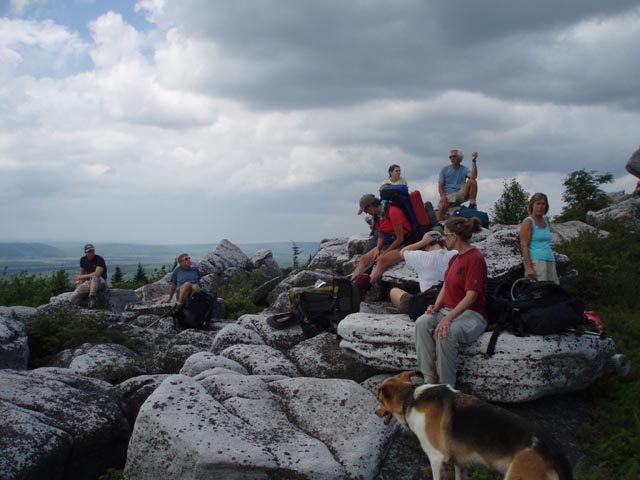
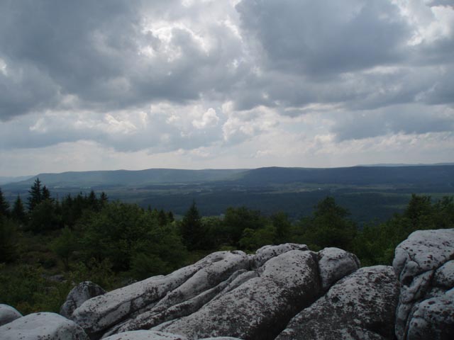
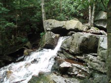
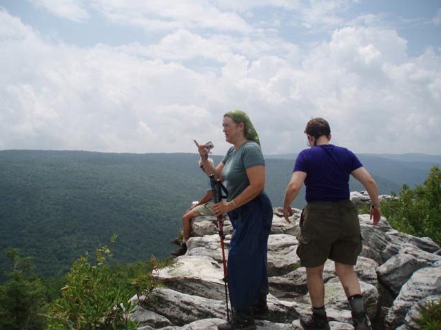
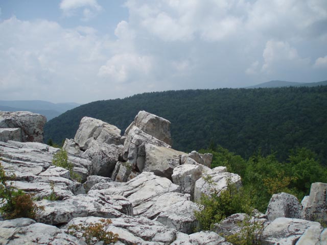
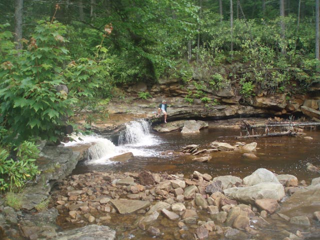
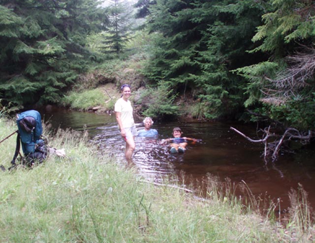
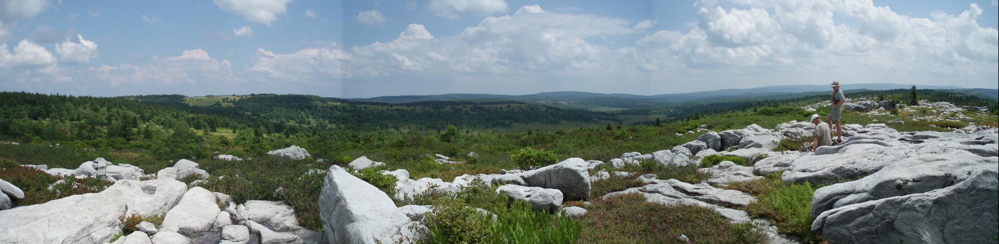
Continue west passing an unsigned trail on the left that eventually connects with Beaver View Trail that you passed earlier. At 0.86 miles from the Spruce Grove turn left onto a footpath cut through some small Red Spruce. In another 0.44 miles arrive at Rocky Ridge Trail (Tr524). Turn left here.

Continue south on Rocky Ridge Trail. At about 1.08 miles the trail veers slightly to the right and crosses Rocky Knob. Weather permitting this is a great lunch spot with views of Canaan Valley and Mountain. You have to rely on several cairns and short patches of footpath to get through this area. 

In about 0.3 miles from Rocky Knob you�ll pass a trail intersection in a wet area with a large boulder. The trail to the left is marked with cairns and leads to a dead end and a possible small emergency campsite should a backpacker need to get off of the ridge. By-pass this trail, pass another dry campsite, and in 0.2 miles arrive at a jeep trail. This is the junction with Dobbin Grade Trail (Tr526). Turn right to stay on Rocky Ridge Trail. Climb up a wide woods road to Harmon Knob in 0.51 miles. The actual knob is marked by a very tall cairn. The viewpoint is across a large rock field along the edge of the ridge. 

Continue south a little further and turn left onto the Harman Tr. In 1.53 miles turn left onto Blackbird Knob Tr. Cross the Left Fork of Red Creek and turn left onto a footpath. Follow it into a large grove of Red Spruce. There are 2 nice campsites on this side and another on the west bank which can be reached via a rock hop. This is camp for the night. (Note: there are a ton of blue berries behind the west bank site in season.

Day 2: Return to the junction of Blackbird Knob Tr and the Harman Trail and follow Blackbird Knob Tr back to the ridge. In 1.89 miles from the last trail junction Rocky Ridge trail will come in from the right.

In 0.25 miles arrive at a large gray kiosk. Breathed Mt Tr in on the left side of it and Big Stonecoal Tr is on the right. Head down Big Stonecoal Trail. WARNING: right at the edge of the woods there is a sink hole. Stay on the logs or circle this area. If you step in it you will find yourself in mud up to your knees!!! Continue downhill, at times walking in a stream. Soon you will be walking on a railroad grade with Big Stonecoal Run coming in from the left and a tributary coming in from the right. At about 0.97 miles from the trail junction with Breathed Mt Trail you will pass a campsite on the left. In another 0.14 miles ford Big Stonecoal Run. There are 2 more campsites right after the ford on the left. The trail then veers east, away from the run and travels roughly along the edge between bogs and grand Pine plantations. These are popular camping spots but I think the closest water source is the run you just crossed. The trail will then turn south for a short distance. Before reaching the southern most edge of the plantation the trail will jog left and uphill through the plantation. A faint trail continuing south (to the right) here will take you out to yet one more great view of highland meadows with a backdrop of mountains. Stay straight on the main trail uphill to continue. The trail will go east for just a little bit before turning south and then bending westward again.

Cross to the west bank of Big Stonecoal at about 1 mile from the previous crossing and head down stream to the junction with DunkenBarger Trail. Perhaps the greatest campsite in the area is immediately to your left in a splendid stand of Spruce. This supposedly used to be an old lumber camp. It's also a great lunch spot.

Continue down the Big Stonecoal Tr. Ford the run and scramble up to an old railroad grade. Visit the waterfall on your right. In 0.56 miles or so Big Stonecoal trail will veer to the right and downhill at the junction with Rocky Point Trail. You want to go straight on Rocky Point Trail, crossing through a rocky area marked by cairns and a very small part-time stream that crosses the trail. At 0.58 miles from the last trail junction and about 5 minutes from the small stream, look for a large cairn on your left. There is a labyrinth of trails here. All will eventually get you to the top but the best one is to the right. You�ll have to step up onto the rocks from the trail. Watch out for the crevices and snakes as you explore the area. On the eastern edge of the rocks you�ll find cairns that will lead you down through a large fissure in the rocks and reconnect you to the unofficial trail. Follow it back down to Rocky point Tr.

Turn left onto the Rocky Point Trail to continue your trek. Soon you will realize why the trail is so named as you begin walking on the old rock ballast used for the logging railroad. In 1.91 miles arrive at what appears to be a four way trail junction. The continuation of the RR grade straight ahead will eventually peter out. Instead turn left onto Red Creek Trail and climb steeply to yet another railroad grade. In 1.36 miles pass the junction with Breathed Mt Trail on the left and in another 0.2 miles ford the Left Fork of Red Creek to arrive at an area popularly known as "The Forks". There is great camping, a waterfall and Olympic size swimming hole here. This is your camp for the night.

Day 3: Continue following Red Creek Tr. It will follow the Left Fork for a while before veering away from it and climbing steeply through a rocky area. You will then pass through alternating open meadows and dense Red Spruce groves. At 0.91 miles from camp arrive at the junction of the Blackbird Knob Tr. There is no sign but it is quite obvious. Turn right and in another 0.31 miles turn left onto Upper Red Creek Tr. Most of this segment is through open meadows with sweeping views. In another 1.26 miles descend to Dobbin Grade. Turn right onto Dobbin Grade but in a very short distance turn left onto Raven Ridge Trail. Gradually climb the ridge for 0.8 miles where you will pass through some nice shade trees and then enter a small grassy area surrounded by trees. Look for 2 stumps to the right of the trail. The first will be about 18 inches tall and 3-4 inches across. The next one is much wider but shorter. Turn right between the 2 stumps and walk into the woods. There you will find an obvious footpath. Follow  it down to another huge meadow. (Note: A couple of enterprising hikers traced a route near the bottom of the woods with thin fallen logs to mark the way.) Shortly after entering the meadow cross a small stream and begin a gradual climb up a "mini-Raven Ridge". There is one rut through the grass which tends to disappear at times but once you reach the crown of the hill it is a straight line shot to reach the Bear Rocks Tr. Keep an eye out straight ahead for a clump of Red Spruce that has a swath cut through it and aim for that. Soon you will find yourself on a double track ATV trail that goes through that swath and joins the trail you hiked at the beginning of the first day. retrace those earlier steps back to your car.

Printable/Downloadable Trail Notes

Critique This Outing

______________________________________

______________________________________


Name: Gumby                                                                                                             Hike: Dolly Sods Circumnavigation-mod 1

Date(s): 10/18-20/13                                                                                              Rating: 4


Critique: Three of us arrived at the trail head late afternoon on Friday October 18 with the goal of camping at the correctly described fantastic but dry campsite where we had a front row seat for an amazingly bright hunters moon. While there were a number of cars parked on the fire road we didn't see anyone on the trail out to our first camp site. The next day we headed for the Red Creek on the Harman Trail, after lunch and water we moved on to camp at the junction with the Dunkenbarger Trail. We passed a few other backpackers and day hikers on Saturday and Sunday, but not many. On Sunday, the view from the rocks off of Rocky Point Trail were spectacular, with excellent fall colors and unspoiled views. We had lunch at the Forks and hiked out, having an excellent dinner at Mallow's Roadside Cafe (get there before 7PM on Sunday). The trails and signs were in good condition, though I am happy that I had gps with me to check our location a few times.

______________________________________


Name: Bubbles                                                                                                           Hike: Dolly Sods Circumnavigation-mod 1 (modified)

Date(s): 07/13-15/13                                                                                              Rating: 4


Critique: We delayed a day (thankfully) due to rain, but still expected wet, humid conditions, and adjusted the full circumnavigation accordingly! It was "boots off" on the Bear Rocks Trail at Red Creek after slogging through the bog leading down to it! The Raven Ridge and Rocky Ridge were fine. There appeared to be a small spring draining water across Rocky Ridge Trail near the two "dry" camp sites: could be seasona1! We opted not to do the Harman/Blackbird Knob loop; staying on the ridge! I validated the existence of the sink hole at the beginning of the Big Stonecoal Trail, saying afterwards that "I seem to remember reading about this somewhere!!" The very nice campsite 1.11 miles down Stonecoal(2nd waypoint) was occupied, so we went down to the merge with the Dunkenbarger. At the ford point before the merge when you cross the creek (logs to the right of the trail) there is a very nice campsite about fifty yards up the creek to the right in a spruce grove! It's by far the best one we found! The next morning we took the Rocky Point Trail around Lion's Head to the Forks. Having been surprised by the really nice weather we expected the area to be crowded. Arriving around noon helped! We had the choice of any site! The south side at the fork is one of the better sites around although it only handles three tents! Hiking out the next morning we wanted to avoid the bogs of Dobbin Grade so we took the Raven Ridge Tr after the Beaver Dam (which has firmed up nicely!), then the Unofficial Dobbin Grade bypass which is marked by a small cairn which is easy to miss! Expecting not-so-good weather and lots of hikers, we had the opposite! Also, the Sunset Restaurant on the east side of Moorefield had some very good food and service (415 South Main St.). Only downside - they were out of their blackberry cobbler!

______________________________________

  Name: gardel                                                                                                            Hike: Dolly Sods Circumnavigation-mod 1
Date: Aug. 24-26, 2012                                                                                            Rating: 5

Critique: Few things are better than they're reported to be. This is one of them. The change in terrain and environment over the course of the hike was remarkable -- starting with high meadows, moving to a windy ridge with beautiful views, then down into a pine forest, lush mixed forest reminiscent of Washington state, rocky mountainsides, waterfalls -- it was all stunning, with something new every hour. We extended the second day to camp at the intersection of Blackbird Knob Trail and Red Creek, which was not as pretty as the Forks, but also less occupied. The final night we had a lot of rain, so instead of getting onto the Beaver View trail, we exited along the Blackbird Knob trail to Red Creek campground and walked up FR 75 to the cars. Even that became a lovely hike as the rain cleared away and left an enveloping fog. I want to go back!

______________________________________

Name: Rexpit                                                                                                              Hike: Dolly Sods circum mod 1
Date: 6/25/12                                                                                                            Rating: 5

Critique: Yep Dolly Sods lives up to all the raving reviews, a truly fantastical place. Hiking here def gives the aura of being in the lord of the rings...shire...or something like that. Everything I've read on the Sods tells of a truly Unique beauty, wind swept mountain balds with a plethora of plant life...yes it's all true. One thing that id like to mention about this place is there are "views" everywhere....literally

______________________________________

Name: Adam                                                                                                              Hike: Dolly Sods Circumnavigation Mod 1
Date: 04/29/11 - 05/01/11                                                                                   Rating: 4.5

Critique: Dolly Sods again shows its magic! Got there late on 4/29, hoping to camp at Red Creek Campground only to find that the gate was still closed, apparently for road repairs according to hikers I saw later in the weekend. Ended up sleeping in my car close to the Dolly Sods picnic area. Woke up early on the 30th, parked at the Rohrbaugh Trailhead at around 7am and went off my with 30lb dog Dexter. We took Rohrbaugh up to Fisher Spring trail (the overlook into Red Creek canyon around mile 2 from Rohrbaugh is stunning). Crossing Red Creek was tough - water was pretty high and running fast (and cold!) Had to carry my pup across for fear he'd be swept away. Continued up Red Creek trail to Blackbird Knob to Upper Red Creek. Upper Red Creek was VERY wet and muddy with all of the recent mud. Azaleas not out yet. Crossing the creek just below the beaver dam and just south of Dobbin Grade was more challenging - the dam was probably 2 times as wide as it was last summer. Busy Beavers! Dobbin Grade was extremely muddy. Took Dobbin Grade to Bear Rocks Trail hoping to camp at site just West of intersection. Seemed to be reserved with two packs leaned up against a tree, but looks like a great campsite. Knowing that most of the sites on the Western side of the Sods are dry, hiked back east on Beaver Creek trail out to FR 75 and down to Blackbird Knob trail. Camped along Red Creek on gorgeous "Island" campsite where creek bends - the other 3 sites in the area were full.
On Sunday morning awoke early to chilly morning. Got on the trail fairly quickly and hiked back out to FR 75 and back down to my car as I dislike backtracking and didn't have the energy to head back into Red Creek canyon and deal with fording the creek again. Road seemed fine.


Thanks for your site - fantastic resource!

______________________________________

Name: Jeff                                                                                                                  Hike: Dolly Sods Circumnavigation Mod1(Modified)
Date: 04/21-22/2011                                                                                                Rating: 5

Critique: We turned our planned 3 days into 2 days because of cold rainy weather. Great hike though. As of 04/22 the gate was closed.

______________________________________

Name: Jared and Britt                                                                                               Hike: Dolly Sods Circumnavigation Mod1(Modified)
Date: 4/13-4/15/2011                                                                                            Rating: 5

Critique: Just got back from our first hike in Dolly Sods. It will not be our last!

We started from FR75 at Bear Rocks trail. The gate heading up to the ridge was open to our surprise (more on this later) since the Ranger office had told me it would not be open until at least the 15th. The road was in pretty good shape. We started from the trail head at noon. Fogged in, misting, windy, and about 34F. Despite the conditions, we were geared up and ready to go. The trail was VERY wet which would be the theme for the entire trip. Thankfully we were well prepared. The first crossing of Red Creek was cold and totally soaked us so we spent some time drying out and warming up there. We camped the first night in the Spruce grove just past Beaver View Trail to get out of the deteriorating conditions. The cold, wet night gave way to 2 days of superb blue sky weather. Day 2 we hiked Raven Ridge and Rocky Ridge and spent a lot of time exploring this area. Due to a late start Day 1 and slow Day 2 we decided to modify our route and took Breathed Mt trail down to the Forks. We had a wonderful campsite next to the falls, took a COLD swim, and did a lot of exploring. We had the Forks all to ourselves until about 8pm when a solo hiker set up camp nearby. Day 3 we slowly packed up and hiked out. There was a very wet and difficult crossing due to high water at Upper Red Creek and Dobbin Grade. We decided to take the alternate "unofficial trail" back up to Bear Rocks hoping to avoid more mud and water but even this trail was super wet. We got back to our car to find a bright orange note attached asking us to shut the FR gate behind us on our way out because it wasn't supposed to be open yet. We must have snuck by as the Ranger was up on the ridge. So as of 4/15, FR75 is still "officially" closed.

All in all trails were well marked and this was an excellent guide! We only saw a day hiking couple near Canaan Valley and the solo hiker at the Forks. There is still some snow up on the ridge which added to the beauty. Thank you for the excellent trail guide. We hope to explore more of the Sods on future trips!

______________________________________

Name: Tom                                                                                                                  Hike: Dolly Sods Circumnavigation Mod1
Date: 9-12/14-2010                                                                                                  Rating: 5

Critique: Two of us did a slight variation of this trip in reverse. Started at Beaver View, turned left onto Dobbin Grade, crossed the beaver dam and took Upper Red Creek Trail to the Forks. First time in this part of the Sods! Fall color was starting to come on with gold and some red. Camped a ways upstream from the Forks on the main stem of Red Creek, and did some exploring. Sweet camping here! Ran into a group from Delaware. Great to see "foreigners" exploring land we Mountaineer natives know and love. Got down to 39 degrees at the Forks. Brrr!!

Day two was a bit of off-trail fun! Headed down Red Creek to Rocky Point trail, and followed it before deciding to bushwhack to the Lion's Head. No trail, no nothing. Just an uphill gut-buster through a boulder field that finally brought us to the rock wall below the overlook. We debated a bit, then scaled the rock face before sharing lunch with a colorful snake on the Lion's Head. Windy day up there, but awesome. Hiked through the dry campsites, then found the official 'unofficial' path down to Rocky Point, where we picked up Big Stonecoal and followed it to the intersection with Rocky Ridge. Turned left to check out the Canaan Valley view, and decided to camp on the summit in a small grove of trees. This turned out to be good choice since we got to watch a cool sunset and a thunderstorm blow through to our south. Crystal clear skies later! Windy and about 45 degrees tonight.

Day three saw us take in all of Rocky Ridge to its terminus with Raven Ridge, where we headed east to Bear Rocks and then back on to Dobbin Grade. In another mile we turned left on Beaver View and, regretfully, out of the Sods.

This is the absolute driest I have ever seen Dolly Sods. Did filter lots of water when I found it since our days were bright, sunny and windy. Most of the views I remember along Big Stonecoal have grown over, but the openness of the northern Sods more than makes up for this. The Lion's Head is a heckuva view. Reminded me of the Canyon Rim Trail over on Roaring Plains.

Saw one deer, three snakes, a toad, a chipmunk and one squirrel in full attack mode! He ran right at us on Big Stonecoal. All the trails we hiked are in good shape, but I did not expect so much signage. Oh well. I guess spending a few bucks for signs is cheaper than mounting a rescue. Can't wait to get back and hit the few trails I haven't seen yet.

______________________________________

Name: Jason                                                                                                               Hike: Dolly Sods Circumnavigation Mod1
Date: 8/21/09-8/23/09                                                                                          Rating: 4.5

Critique: First, thanks to Mike for this excellent website and for his quick replies to my email inquiries. We intended to do the Dolly Sods Circumnavigation Mod trip, but made a few changes to our itinerary due to a late start on Friday (driving in from Michigan and Ohio). The two changes were: 1) did not hike the Harman Trail/Blackbird Knob Trail loop, and 2) used the Dobbin Grade Trail on our return versus Raven Ridge Trail and the unofficial by-pass (wish we hadn't made this decision).

We started from the Bear Rocks trailhead at 6:30pm on Friday and arrived at the first campsite at the Red Creek crossing around 7:00pm. This was an excellent campsite that holds maybe 4-5 tents right along Red Creek. Nice fire pit as well, although we didn't have a fire (too wet, too late). We did hear some wild dogs howling on the ridge around 4:00am, but otherwise an uneventful night (not counting our bear bagging experience, which is always eventful).

Day 2 started early with an incredible hike up Raven Ridge and along Rocky Ridge. This is the highlight of the trip as far as views are concerned. The trails were fairly flat with only a few short climbs. The main challenge is the lack of signage in certain places, mud and bogs and rocky sections. As mentioned, we bypassed the Harman/Blackbird loop due to our late start on Day 1. Continuing south along the Rocky Ridge Trail was incredible with several large rock formations and views.

At the kiosk at the intersection of the Breathed Mt Trail and Big Stonecoal Trail, we missed a trail sign and simply headed to the right. About 20 minutes later we realized we were on Public Road 80 and back-tracked where we found the sign for Big Stonecoal Trail.

Rocky Point Trail certainly earns its nickname with at least a few miles of some of the rockiest trails I have hiked. Also, there was some confusion among our group and another group as to which route to the top of Lions Head was the "best". We chose the second cairn, which led us up a confusing and overgrown path, then to some nice rock scrambling to get up top. We came down the same route. Lions Head was incredible and worth the navigational effort.

We camped at The Forks. There are several campsites in this area, some better than others. Make sure you walk around and up the trail to survey all of the sites. We had actually decided to move on to Blackbird Knob to camp and passed a nice site while hiking out of The Forks campsite. It had room for several tents and was right along Red Creek. Two nights sleeping with water in the background was perfect and I slept better than I've ever slept while hiking. Day 2 was some of the best backpacking I have experienced.

Day 3 was a short hike out, but not without some great mud bogs and river crossings. The crossing of Red Creek at the intersection of Upper Red Creek Trail and Dobbin Grade Trail was a nice rock hop. We chose to hike the Dobbin Grade Trail instead of Raven Ridge. This turned out to be a mistake as Dobbin Grade was very muddy with plenty of mud up to your ankle moments. Given it was our last leg, we were happy to play in the mud and clean up at the trailhead. The Raven Ridge Trail could be seen higher up on our left as we mudded our way through.

Overall this was an awesome hike. One I would recommend to anyone who has some experience in backpacking and reading a map. There are some sections that are under-signed, however it certainly didn't detract from the trip. I look forward to returning to the area.

______________________________________

Name: Jimmy Bair                                                                                                      Hike: Dolly Sods circumnavigation Mod 1 (sort of)
Date: June 5-7, 2009                                                                                                 Rating: 4

Critique: My 12yo son and I set out to complete this walk the first weekend after school let out for the summer. Little did I know that the days leading up to our hike would bring heavy rain to the sods. On Friday morning we drove up the fire road in driving rain and fog. We delayed our hike until the afternoon which was only slightly better with steady mist and visibility of about 20 yards.

As we moved off the fire road we found the trail nearly impassable about 200 yards in. after an hour detour around several run-offs, we came upon the trail and followed it up the ridge. The trail condition improved and we rambled on to the intersection of Bear Rocks Trail and Dobbin Glade Trial.

We took a break since the rain and mist kind of stopped. We could hear Red Creek off in the distace, but visibility hadn't improved so we didn't know what lay ahead.

We found Red Creek to be rushing over its banks. The stepping stones marking the trail lay 3 or 4 feet below the rushing water. After checking up and down stream with no luck finding a better ford, we decided to head down Dobbin Grade trail to see what we would find.

Dobbin Grade trail was impassable about a quarter mile from Bear Rocks Trail.

We decided to head back to Bear Rocks Trail, turn right head up to the ridge and find a camp. We settled in and sacked out in the fog.

The next morning we awoke to brilliant clear skies and perfect temperatures. We headed down the trail to find Red creek passable and set off for Rocky Ridge. the scenery and weather were beautiful. After lunching at the rocks on the ridge we decided to stay on the ridge for the evening. We made camp at a very cool campsite below a giant boulder about five minute walk before the trail takes you over the boulder hop. We spent the rest of the day exploring the ridge. We hiked down to the intersection with the Dobbin Grade Trail, then back to the ridge for dinner.

Sunday morning dawned just as beautifully as Saturday. We took our time backtracking over the last two days' hike and returned to our car by 1pm.

This is a beautiful hike, and even though the weather thwarted our attempt at circumnavigation, we had a wonderful time. We will surely be back.

I found the trail conditions to be just what we expected. One observation (criticism?) I have is the seemingly lack of forethought to trail signage. I have no problem with the lack of signs, (We wanted to go to the NF to practice our navigation) but I don't understand why areas like the glades going up Raven Ridge Trail where you can easily identify the trail from a half mile away are heavily signed, but when going through Spruce groves where you can't easily identify the correct trails aren't signed at all.

Thanks to Mr. Hyker for the advice and a great website!

______________________________________

Name: Rehingd                                                                                                           Hike: Dolly Sods Circumnavigation - mod1
Date: 6/30/08-7/3/08                                                                                            Rating: 5

Critique: A friend and I did this hike mid-week and saw only 2 people until the Forks, and even there things were not busy at all. I would not consider this hike difficult. Just enough elevation change to get your heart beating once or twice per day. Otherwise the only difficulty of the terrain is walking on rocks and wet ground. This was a relaxing and absolutely beautiful hike with great campsites. I definitely hope to return.

If you have the luxury of timing your trip with the weather, try for clear skies on Day 1. We had a lot of fog and mist on Day 1 that blocked most of the D.S. North landscape, which otherwise would have been the most impressive views of the trip.

There is a great variety of landscape in both the North and South sections of this hike. The North is more unusual and impressive. The South, while very nice, is more typical of mid-Atlantic hikes.

Navigation notes:
We only had a couple of difficulties, both of which may have been solved if we relied on our GPS throughout:

At the beginning of Day 3, we had trouble figuring out which of the many small trails through The Forks camping area was the continuation of Red Creek Trail. It's a left turn, maybe 30 yards past the Red Creek crossing that ends Day 2.

Also, I don't think we ever found the correct stumps where we were to leave Raven Ridge Trail on Day 3. We ended up doing a 1mile bushwhack East back to Dobbins Grade. Happily we were not blown to smithereens by any undetonated munitions. And we found a great swimming hole.

Some Q/A from my first visit to Dolly Sods... maybe helpful to others:

Availability of drinkable water? Not a problem on our trip, and I wouldn't expect a problem even in dryer conditions. Much of Day 1 is dry, but otherwise we did not need replenish water on most of our chances to do so.

Low Temps? As expected, it's colder here than in surrounding areas. It was down to the upper 40's one night. Plant-life is weeks behind other mid-Atlantic areas.

Hammock camping? Yes! The camping areas have plenty of trees to hang from. Prepare for the cool nights. I was quite happy in a Hennessy Ultralight with half a Walmart blue pad under my torso and a down vest stretched under my legs.

Biting Insects? Basically none on our visit. Repellant did not leave the backpack.

Footwear? I made out ok in trail running shoes. Those with ankle concerns will want boots to account for the rocky terrain. A little more sole protection may have been nice for the same reason. Your shoes will get wet.

Travel by Motorcycle? FR75 has some rocks, but is no problem for any car with average clearance. My motorcycle is made for some light off-pavement riding and was fine. My friend was on a large Harley Duo-glide and had a little more challenge, but he made it without incident.

An exceptional trip. Thank you!

______________________________________

Name: Eric Cober                                                                                                       Hike: Dolly Sods Circumnavigation - mod 1
Date: 4/23/08 - 4/25/08                                                                                        Rating: 4.5

Critique: Went late April 2008 (23 - 25). Bumped into only one other hiking party mid-week, but several groups were on way in Friday afternoon. Trails in Dolly Sods North very well marked, with signed junctions and trail markers. Raven Ridge essentially dry, not really any good place to camp up there. Itinerary good for 3 days, but in Wilderness area trails rocky, wet, muddy. A nice rugged trip. Campsite first night at Red Creek off of Blackbird Knob trail nice. 2nd night at the Forks fabulous, but apt to be quite busy in season. Overall, rough terrain and poorly maintained trails; not for inexperienced backpackers.

______________________________________

VA Hikes MD Hikes WV Hikes PA Hikes Contact Us Home