
|
Dolly Sods
Trans-Navigation 08/14/2011 |
|
|
Description:
Up to this point
in time I have hiked nearly every trail in Dolly Sods, many of
them multiple times. I can count the number of trails I haven�t
hiked on two fingers; the Beaver Dam and Beaver View Trails.
I�ve completed two different circumnavigations and a series of
circuits and out-and-backs forming somewhat of a loose chain
stretching from Laneville to Bear Rocks. Ever since the addition
of DSN to the Wilderness I�ve had this desire to
�trans-navigate� the venue, hiking from some point in the south
to its northern boundary. Described here is a 15.9 mile shuttle
visiting several of the hallmarks of Dolly Sods. Although
someone in good physical condition with an early start could
probably do this in a day I feel that you'd be doing the place a
disservice. Strap on the ol' pack and spend two or three days
exploring this wonderful place.
Google Custom Directions to the north trailhead Shuttle Directions |
|
________________________________________ |
|
Zipped National Geographic TOPO! GPS and Universal GPS Files |
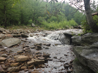
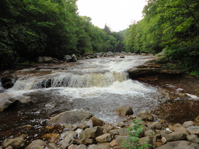
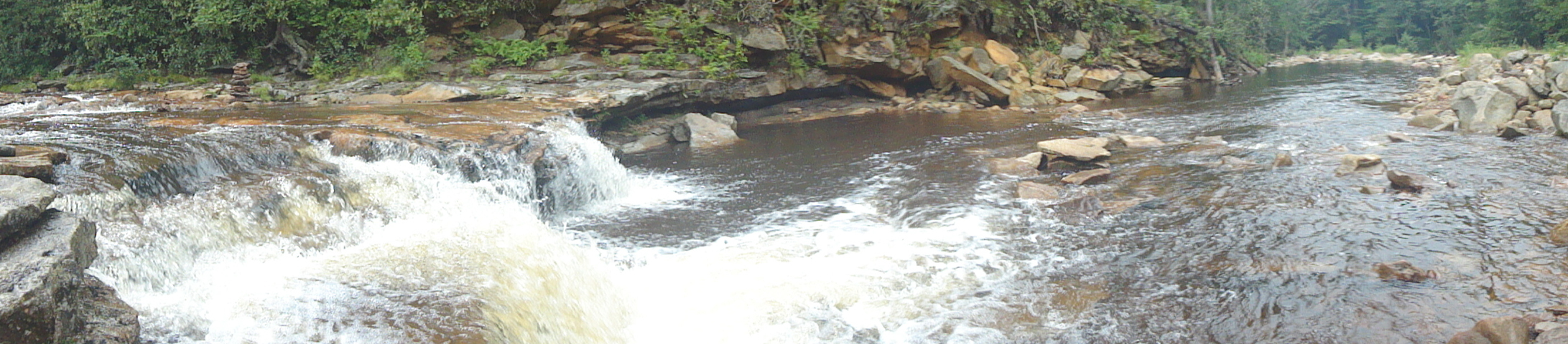
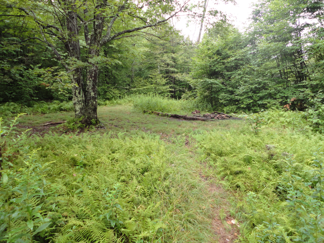
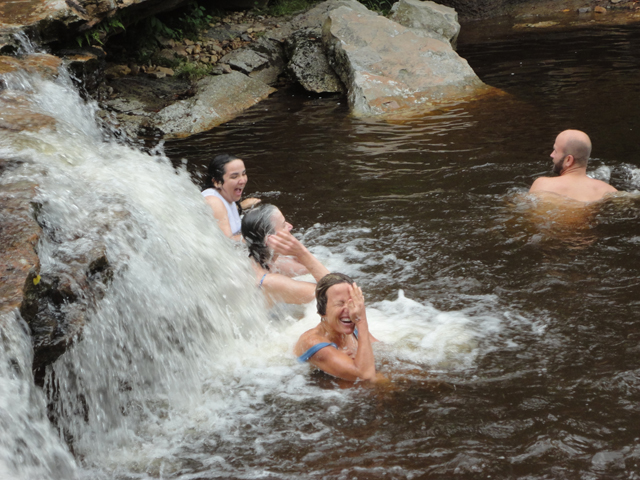
Trail Notes: From the parking area on FR 19, walk down the road a few yards and turn right onto the Rohrbaugh Plains Trail. Initially you will be walking through Red Spruce, lush Rhododendron and moss covered rocks. Cross an old wood roads at 0.8 roads. You�ll pass a couple of nice, grassy campsites. They are dry but there are streams a little further along the trail. In 1.9 miles reach the Un-named Vista. Besides nice views there is some good camping here. The trail turns into a wide woods road. The trail splits off to the left in another 0.8 miles. (The road continues to the right until it ends at FR75.) In 0.6 miles, after crossing Fisher Spring Run, arrive at the junction of the trail by the same name. As evidenced by left over stone ballast, wooden ties and a few rusty spikes, you�ve been walking on an old railroad grade since leaving the road. This continues for a bit longer as you bear left here. Shortly the grade will be blocked by old logs. Turn left here and switchback steeply downhill, once again crossing the run. Immediately after the crossing turn right at a cairn and soon pick up another old grade. In 1.3 miles arrive at Red Creek Trail. Turn right and descend to the ford marked by a high stump and a cairn or two. If you wish to camp on this side of the creek, look over your right shoulder (as you face the creek) and find a hidden railroad grade. There is a great campsite about 0.2 miles along it with more camping and a nice waterfall and swimming hole an equivalent distance upstream. To continue the hike, return to the ford and cross the creek. A large boulder and cairns mark the continuation of the trail on the opposite bank. The trail climbs gradually at first, passing at least three nice campsites (one next to the previously mentioned waterfall) before turning sharply uphill, away from the creek. It climbs steeply, passing Rocky Point Trail (not shown on the map), before depositing you on yet another railroad grade. As you hike along on a nearly flat tread you can here the creek racing up to join you. There must be some wild waterfalls along this stretch that most folks have never seen. In 2.7 miles from the ford pass Breathed Mountain Trail on the left and then ford the Left Fork of Red Creek. By this time you have already passed two more campsites but �The Forks� is the place you want to be with its large complex of campsites, waterfall and Olympic size swimming hole. |
|
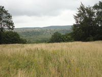
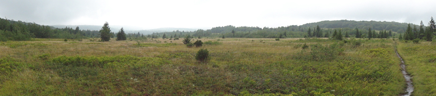
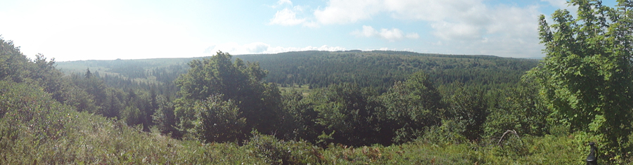
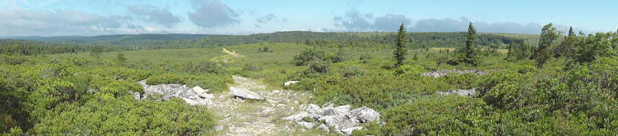
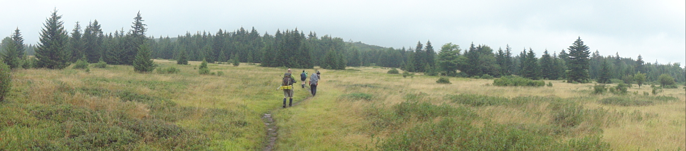
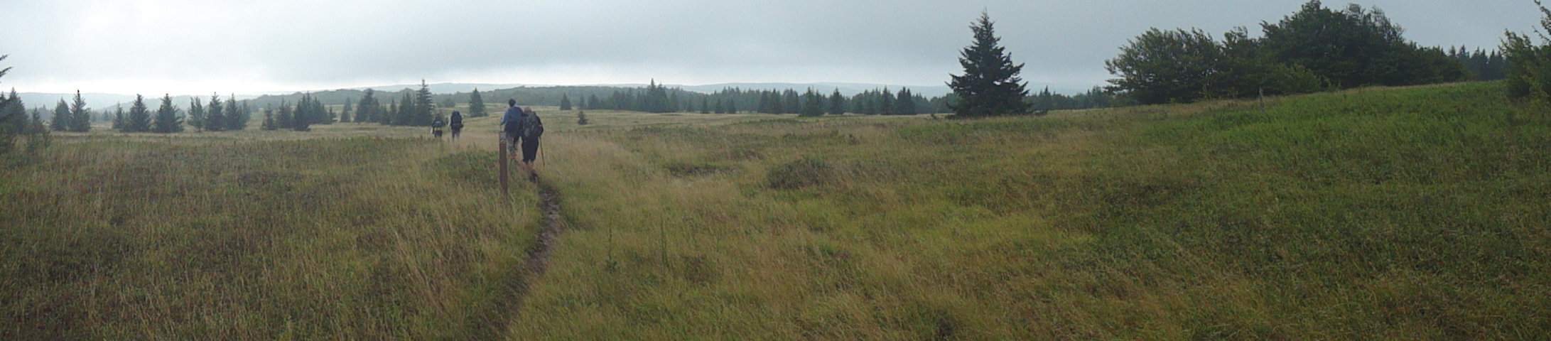
The trail continues to the left of the ford, at first following the north bank of the Left Fork before turning away and climbing steeply through a rocky area to the first of two or three meadows full of blueberries and Saint Johnswort. In between these meadows you�ll pass through dense Red Spruce until you reach the junction with Blackbird Knob Trail. Turn right but in 0.4 miles turn left onto the Upper Red Creek Trail. With the exception of some Quaking Aspen at the beginning and a small wooded area at the end the next 1.3 miles follows the edge of a wide open meadow with the surrounding mountains serving as a backdrop. Near its end you�ll catch a window sized view of the bogs of Dolly Sods North. Don�t spend too much time here as a better view awaits you. Begin your descent after passing a nice campsite on the left. Recently (circa 2010) beavers have moved into the neighborhood, building a series of dams along what I call, for a lack of an official name on any maps, Dobbin Run. This construction has created a pond at the location of what was once always an easy rock hop. Here you will have to take your boots off and wade across. There is no other way around it. After drying off, turn left onto Dobbin Grade, crossing the run and several streams that once held more beaver ponds. In 0.6 miles from the last trail junction pass a piped spring, the last water source for several miles. In another 0.2 miles turn right onto the Beaver View Trail. At first it ascends gradually through a hardwood forest but abruptly gives way to open meadows, each successive one becoming larger until you come upon wide open Raven Ridge. In 1.3 miles from leaving Dobbin Grade you will see the sign for the junction with the trail of the same name. Now here I am going to tell you a secret but it comes with a price ... a promise to all other backpackers, if you will. Stop about 30 yards short of the trail junction. To the left will be two deciduous trees, one behind the other, with a large grove of Red Spruce behind it. Follow a straight line through the grass and blueberries, splitting the two trees, until you reach the grove. Here you will find one of the best campsites in the entire sods. All you will have to listen to at night is the wind blowing across the ridge. OK, I said there was a pledge involved. If you decide to use this campsite please do not break any more branches off of standing trees or chop down any living trees as past �wanna be� backpackers have done. When finished with the place clean it up, making it better than it was before your arrival. I�m trusting you to do this. Now to continue with the hike, turn right onto the Raven Ridge Trail. In 0.2 miles bear left onto the Bear Rocks Trail. You will dip down at first and then climb a bit through more open terrain until you finally pass through a wooded area. Boardwalks now replace a muddy slog through a perpetual seep, allowing it to become a grassy bog instead of a black mud hole. The trail turns left on an old ATV trail but only for a short distance before giving it leave and descend to Red Creek where there is more good camping and the last stream crossing of the trip. This is 1.3 miles from leaving the Raven Ridge trail. Complete the ford and cross another bog on a boardwalk before crossing Dobbin Grade. Over the next mile you will climb over two slight hills and pass even more open views of the Sods. Turn left onto FR75 and return to your plant vehicle(s).
________________________________________
________________________________________ |
|
|