|
The Dragon's Tooth |
|
Saki's Full Trip Report and Photos |
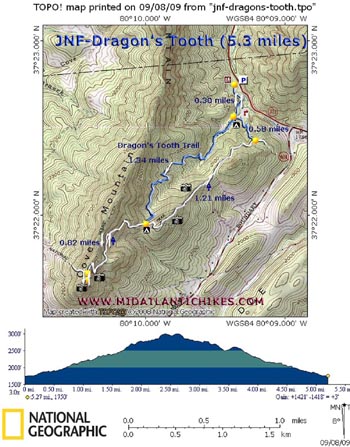
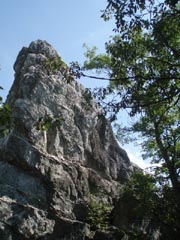
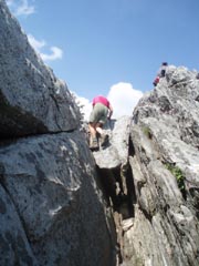
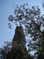
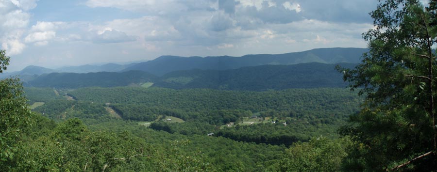
Description: The Dragon�s Tooth is the southern most jewel in �Virginia�s Triple Crown of Hiking�. (McAfee Knob and Tinker Cliffs being the other two.) Although only 5.3 miles in length we give this hike a strenuous rating primarily because of the 0.8 mile rock scramble to the top. The level of difficulty increases even more if you attempt to summit the tooth itself. The descent along the rock scramble is nearly as challenging as the ascent. Given the degree of difficulty don�t expect this outing to offer a lot in the way of solitude. This place is a magnet to the students of VT which is mere minutes away from the trailhead. It seems like the first place they head to on the weekends. Google Maps Custom Driving Directions The hike starts at the Dragon's Tooth Trailhead Parking Lot on VA Rt 311. |
|
________________________________________ |
|
Zipped National Geographic. TOPO! GPS and Universal GPX Files |
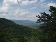
Trail Notes: From the kiosk at the back of the lot walk south on the blue blazed Dragon�s Tooth Trail. In 0.30 miles arrive at the junction with the Scout Trail on the left and some good campsites that are often frequented by the above students. (The stream here tends to cease flowing in the summer months but you may be able to find enough water in the deeper pools should you wish to camp here.) Bear right, staying on the Dragon�s Tooth Trail and begin a gradual climb. In 1.34 miles the trail joins the AT at a very nice but dry campsite in a saddle between two mountains. Turn right onto the white blazed AT and soon start the rock scramble. The trail is well blazed. You may see a false trail on the right about halfway up. Pass it. Just above the last scramble pass a nice vista and in 0.82 miles from joining the AT turn left onto a spur trail that leads to the Dragon�s Tooth. Along this short stretch the trail splits a couple of times but they all come back together at or close to the Tooth.
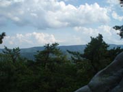
After exploring the area and taking a much deserved break return to the dry campsite mentioned previously. For more views and perhaps a little bit of solitude (The vast majority of hikers simply return to the parking lot via the Dragon�s Tooth Trail.) bear right, staying on the AT. After a short, steep climb you�ll descend along a narrow, rocky ridge covered in Mountain Laurel and pine. In 1.21 miles from the last trail junction make a sharp left onto the Scout trail. In another 0.58 miles turn right onto the Dragon�s Tooth Trail and retrace your initial steps of the day back to your vehicle.
|
|
________________________________________
________________________________________ |
|
|