|
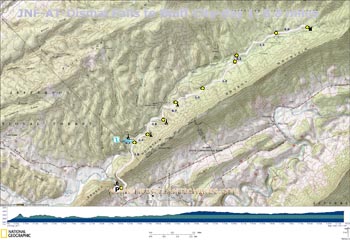
Printable/Downloadable Map
View 3-D Map
GPS Text File for
Non-TOPO! Users
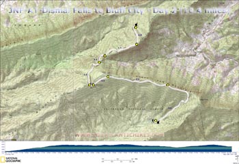
Printable/Downloadable Map
View 3-D Map
GPS Text File for
Non-TOPO! Users
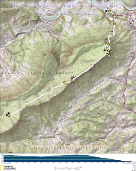
Printable/Downloadable Map
View 3-D Map
GPS Text File for
Non-TOPO! Users
Zipped National Geographic. TOPO! GPS and Universal GPX
Files for the entire trip |
Trail Notes:
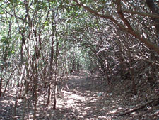
As usual the AT is blazed with white paint. Side trails
are blazed with blue.
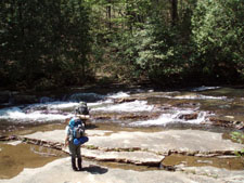
Day 1, 8.8 miles, 1300
feet E.G.: From Route 606/Wilderness Road begin a
gradual climb up and over the gap of Brushy Mountain
created by Kimberly Run. In 1.8 miles reach the blue
blazed
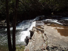
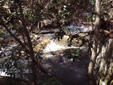
Dismal Falls
Trail. Turn left and follow it to its
end. After taking a break and a few photos return to the
AT. You�ll pass a nice campsite along the way. Turn left
onto the AT. In 0.4, 0.8 and 0.7 miles pass potential,
small campsites along the creek or one of its many
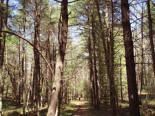
tributaries. The trail climbs away from the creek,
passing through two groves of
giant White Pine. At 1.0 miles an old woods road
comes in from the left. The trail descends for 1.2 miles
and crosses a service road. Cross the creek and in 0.2
miles from the road arrive at the junction with a dark
blue blazed trail on the left. This trail has been
partially blocked with branches. It is an old route of
the AT and led to the original site of the Wapiti
shelter. Both were relocated after the gruesome murder
of two hikers in May, 1981. Continue on the AT. In 1.3
miles the trail splits. Stay right on the AT and pass an
old pond whose dam had been breached. Arrive at the turn
off for the Wapiti shelter in 0.9 miles from the split.
There is plenty of room for tenting if you do not wish
to use the shelter.
Day 2, 10.4 miles, 2280
feet E.G.: You can either backtrack to the AT or
continue on the blue spur that runs through the camping
area to rejoin it. Turn right on the AT. After an easy
warm-up along the creek begin a relatively steep climb.
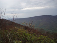
The trail will make a 90 degree left hand turn and reach
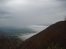
the crest of Sugar Run Mountain. There is a great view
of Wilburn Valley below and
Pearis Mountain to the left from a rocky precipice
on the right 3.0 miles after leaving the shelter. A keen
eye might pick out the gap where your home for the
night, Doc�s Knob Shelter, is located. From here the
trail descends a bit to join an old haul road. Enjoy
easy hiking for the next 2.4 miles. The AT will then
turn left onto a footpath to avoid a radio facility.
Cross a woods road in 0.6 miles and then the tower
access road in another 0.2 miles. Here the trail cuts
through a gap between Sugar Run and Flat Top Mountains.
In 1.3 miles from crossing the tower access road cross
another old haul road. Arrive at gravel Sugar Run Road
in 0.5 miles. There is a hostel open during the AT
hiking season about 0.5 miles down the road, heading
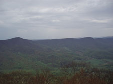
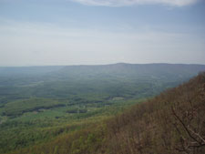
east (to your right). The next 1.5 miles is extremely
rocky. It reminds me more of PA than VA. You are
rewarded with another view of Wilburn Valley just before
turning left and descending 0.8 miles to Doc�s Knob
Shelter. The ground is not very tent-friendly but if you
look around in the Rhodies you will find a small piece
of earth for your tent.
Day 3, 10.2 miles, 911
feet E.G.: Right out of camp you continue on a pleasant
old haul road, surrounded often by Rhododendron. The
trail stays below the crest of Pearis Mountain for 3.5
miles and then leaves the old road to climb up to a
power line right of way, vista and dry campsite. The
trail continues to climb but very gradually, reaching
a
miniature Tinkers Cliff in 2.2 miles. This is your
last view of Wilburn Valley. In 0.2 miles pass a blue
blazed spur on the left that leads to a spring and
possible camp area. Most of the trees on this part of
the mountain had been killed by some blight, perhaps
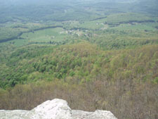
Gypsy Moths. The trail descends through a rock city
reaching the spur trail to
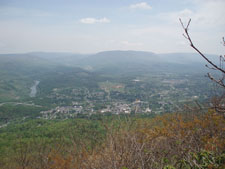
Angels Rest in 0.4 miles from the spring trail.
Besides the New River and surrounding mountains you can
also see the towns of Pearis and Narrows. You might even
be able to see your vehicle. From here the AT descends
rapidly via a never ending series of nice switchbacks
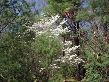
and stone steeps. The trees are tall and the path is
lined with wildflowers in the spring. Cross gravel Rt634
in 2.5 miles. The trail then turns left on a residential
road for a few steps before turning right, passing
through a grassy area with evergreens. Turn left onto
Rt100 and then right onto Thomas Drive. Carefully cross
U.S. 460. Turn left and follow the shoulder for 0.3
miles back to your vehicle.
Critique This
Outing |