|
Cranberry Backcountry Backpack |
|
|
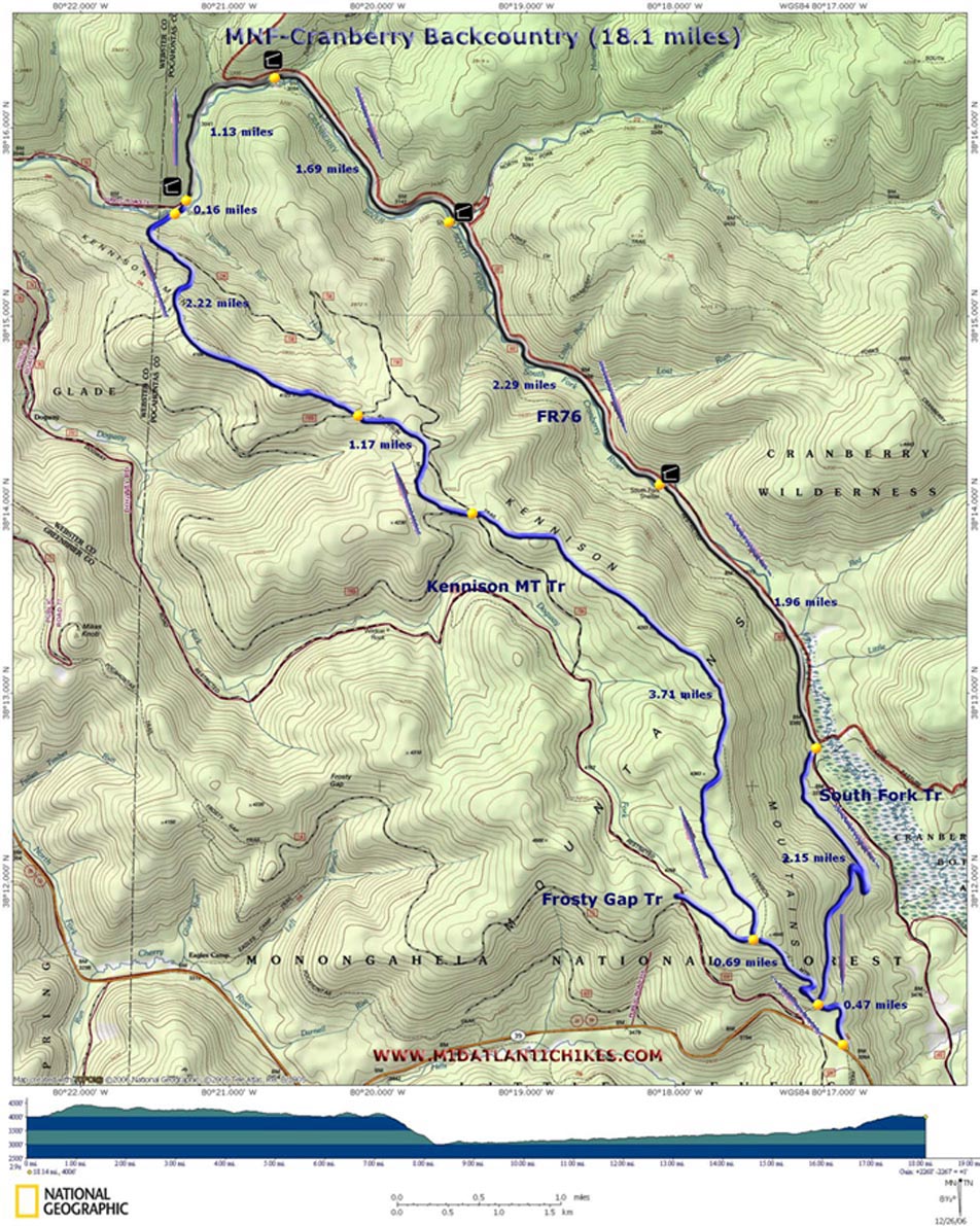
Description: This is a moderate 18.1 mile overnight
backpacking trip. We actually had a much longer and strenuous 3
day trip in mind when we set out to hike this one. Unfortunately
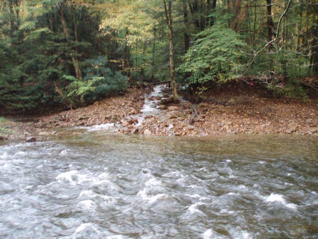
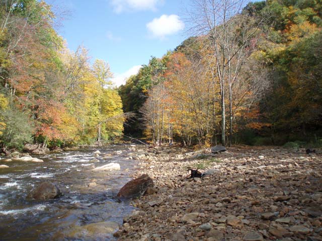
the Cranberry River was running too high and fast to cross where
we had planned on the second day so we had to alter our course.
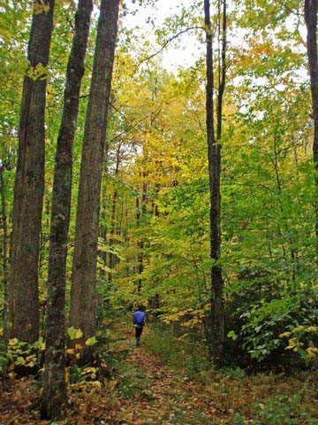
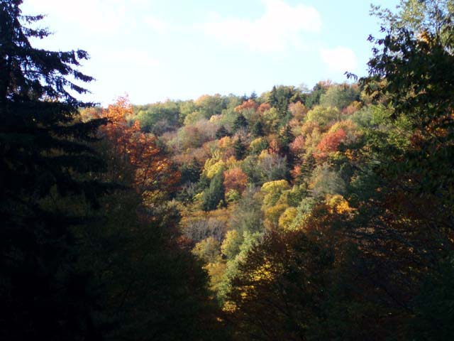
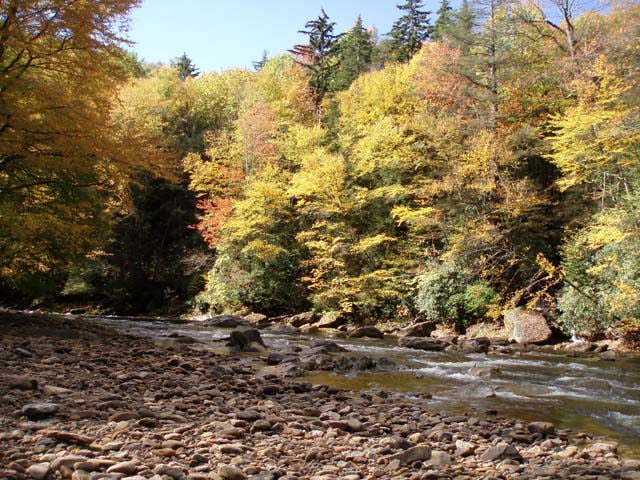
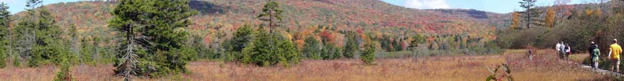
The trip described here is a result of our failed attempt. The initial climb up to Kennison Mt is relatively steep but is over, for the most part, in about 1.2 miles. The walk across the ridge is relatively flat. The Spruce, birch, maple and Cherry forest is primo. There are some seeps to slog through but the worst ones have been recently bridged with some very nice boardwalks. The descent to the Cranberry River is quite steep (nearly 1500 feet in less than 1.5 miles). Then you have to ford the river. Despite what other references might state we found no good campsites on the west bank of the river. You will have to ford it on the first day. |
|
SAFETY NOTE: The Cranberry River ford can range from a rock hop to an easy wade to a dangerous if not impossible ford. I've seen the water level at this crossing as low as 6 inches to as high as almost 3 feet. We recommend that you monitor the weather for Richwood, WV for the 2 weeks prior to your trip and that you contact the Gauley Ranger District (304-846-2695 ) about weather and river conditions before making a final commitment.
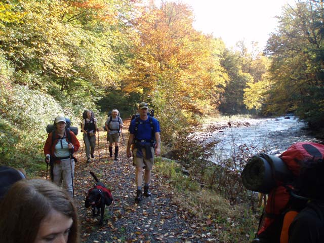
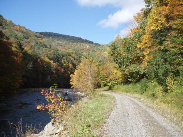
Once across the river you'll have a pretty pleasant 7.5 mile road walk through one of the prettiest river valleys in the state. Especially in the Fall you will soon forget that you are walking on a road. There are 3 shelters and a couple of campsites along the forest road. In season they are frequented by fishermen. Still there is good camping in the general vicinity of the shelters and a few dispersed camping sites in between. The hike ends with a pretty prolonged climb along the South Fork Tr to the Kennison Mt Tr and then the return to your car. Although there are no vistas on this or the Kennison Mt Tr the quality of your surroundings are quite pleasing.
The trailhead is at a gravel parking area for the Kennison Mt Tr (signed) on the north side of RT39.
______________________________________ |
Zipped National Geographic. TOPO! GPS and Universal GPX Files |
Trail Notes: The Kennison Mountain Tr and the South Fork Tr are blazed with blue diamonds. FR76 is not blazed but is a quite obvious gravel road that is closed to motorized travel. SAFETY NOTE: The Cranberry River ford can range from a rock hop to an easy wade to a dangerous if not impossible ford. I've seen the water level at this crossing as low as 6 inches to as high as almost 3 feet. We recommend that you monitor the weather for Richwood, WV for the 2 weeks prior to your trip and that you contact the Gauley Ranger District (304-846-2695 ) about weather and river conditions before making a final commitment. From the parking area proceed north up Kennison Mt Tr. Initially the grade will be gradual but will get steeper near the top for a short distance. At 0.47 miles pass the junction with the South Prong Tr (Your return route) on the right. In another 0.69 miles arrive at the junction with the Frosty Gap Tr (straight ahead). You want to turn right to stay on the Kennison Mt Tr. For the next 3.71 miles you will walk through some wonderful mixed forest containing Red Spruce, Hemlock, Cherry, Birch and other species. Parts of the trail will be quite boggy. The worst seeps are traversed by recently constructed boardwalks. The last and longest is approximately 200 yards long. In 3.71 miles from the last trail junction cross FR738A. In another 1.17 miles cross FR738B. In about 0.4 miles you will reach the highpoint of Kennison Mountain. You'll stay relatively flat for about another 0.6 miles. The last mile or so features a 1000 foot descent to the Cranberry River below. Find the best place to cross and ford the river with caution. After completing the ford turn right (upstream) and walk about 100 yards to a nice campsite. A shelter and more camping is just a little further up the stream. This ends the first day of this trek as described here. The next day proceed up FR76 (upstream). You'll pass other shelters marked on the map. |
|
Keep an eye out for trail signs on the left. These lead to even more great hiking for another day. In 7.5 miles from last night's camp/ford arrive at the Cow Pasture Tr on the left and the South Fork Tr on the right. Take the South Prong Tr. There are no grand views or waterfalls here but like the Kennison Mt Tr you traveled the day before the surrounding forest is scenic in its own right. For the next 2.15 miles the trail gradually climbs up the flank of the mountain. There are 2 switchbacks along the way but they do little to lessen the difficulty of the climb. As the trail finally flattens out it joins the Kennison Mt Tr. Turn left and retrace your initial steeps back to the car.
Printable/Downloadable Directions and Trail Notes ______________________________________
______________________________________
Name: Dave
Watts
Hike: Cranberry Backcountry backpack ______________________________________ |
|
|