
|
Cowans Gap SP - Tuscarora Tr |
|
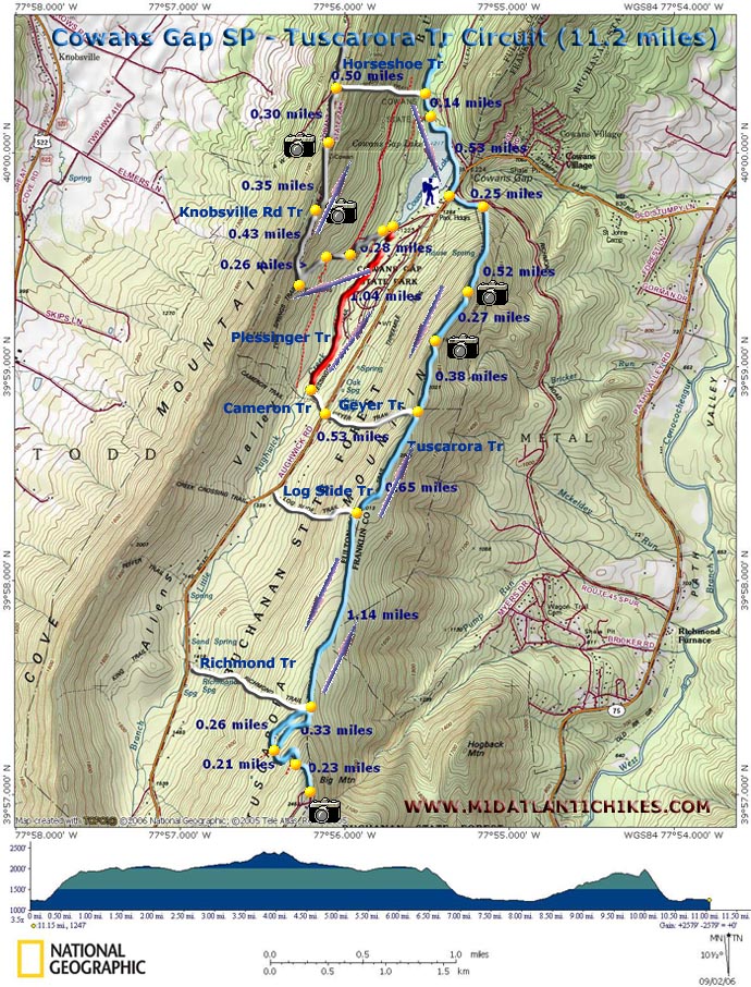
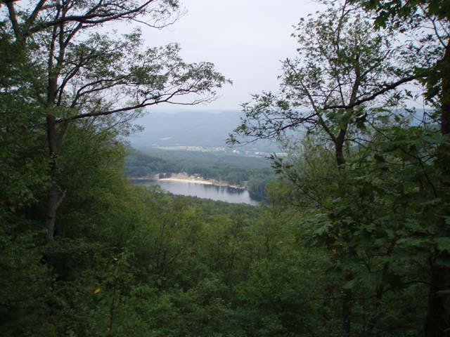
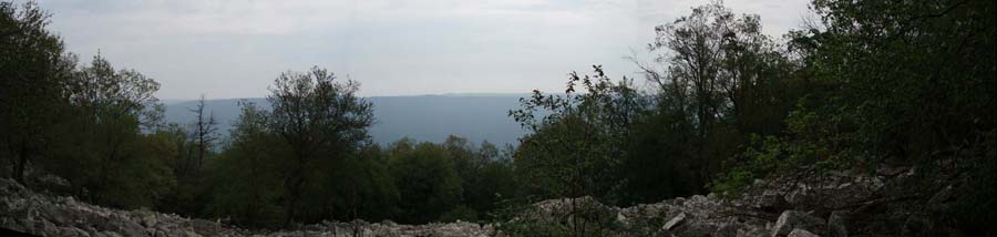
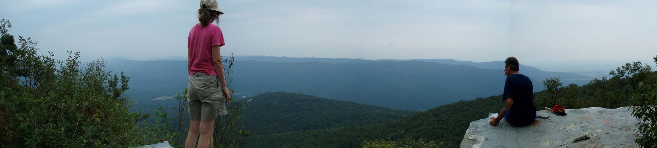
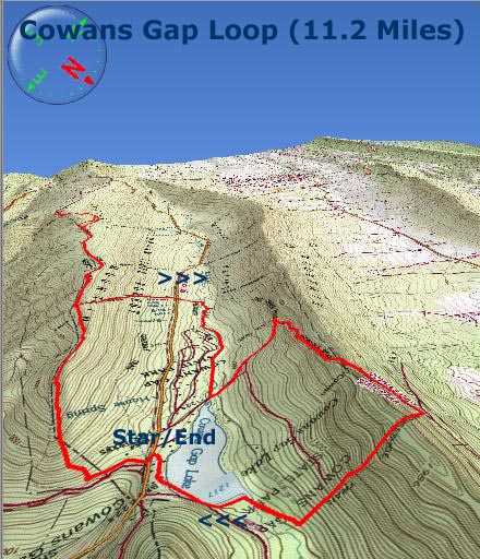
Description: I�ve been looking for some more challenging PA day hikes within driving distance of Baltimore. We�ve pretty much covered all the trails in the Holtwood Recreation Area in the east and Michaux State Forest in South - Central PA. Gifford SP, also in the east, is on the schedule for this fall. Internet searches kept coming up with hits for Cowans Gap State Park in Buchanan State Forest. So I thought we�d check it out. I was not disappointed even though the hike described here includes a 5 mile out-and-back (total) and I am not a big fan of retracing my steps any appreciable distance. The vista (even with the graffiti) was well worth it. This is an 11.2 mile strenuous circuit. It can be shortened by removing the out-and-back to the best vista in Southern PA and/or the climb up to Cowans Mountain for even more views. If you do the entire circuit you�ll gain 2100 feet in elevation and lose just as much. Some of this is quite steep, especially at the beginning as you ascend rocky Tuscarora Mt and also near the end of the hike on either side of Cowans Mt as you traverse the Horseshoe Tr. |
|
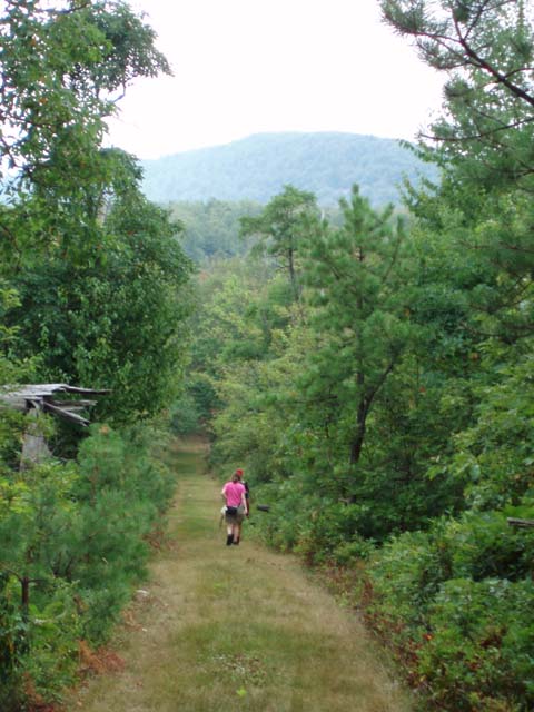
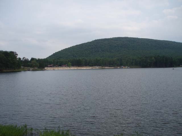
I�ve never been on a steeper trail, not even in the Black Forest. A short portion of the hike follows the edge of the campgrounds but that�s no bother since it seems the campers aren�t aware of the existence of the trail. We found little litter there. The rewards for your efforts are 5 vistas, a stroll along a pretty stream, the lake itself and one hell of a workout. Allow plenty of time for this one! Park in the lot closest to the bathrooms. The Tuscarora Trail is part of the Great Eastern Trail (GET). ________________________________________ |
Zipped National Geographic. TOPO! GPS and Universal GPX Files |
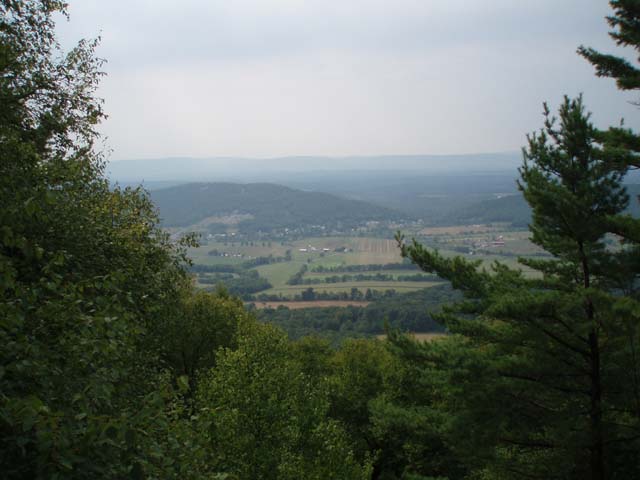
Trail Notes: All trails are blazed (except for the Knobsville Rd Tr) and signed at the junctions. The colors on the map match the colors of the blazes. From the bathrooms cross Aughwick Rd and walk back down towards the triangle intersection. Turn right into a small picnic area. The blue blazes for the Tuscarora Tr starts on an old woods road that parallels Richmond road which you drove up on. In 0.25 miles from the start turn right onto a footpath and begin climbing to the ridge of Tuscarora Mt. The climb is aided by recently installed switchbacks. Notice that you�ll cross the original trail several times as you climb. As you ascend the trail becomes rockier. You�ll pass vistas on the left in another 0.52 and then 0.27 miles more further up the ridge. In another 0.38 miles the tread changes into a grassy jeep road with the junction of Geyer Tr on the right. Stay straight on the Tuscarora Tr. Pass the junction of white blazed Log Slide Tr on the right in 0.65 miles. Watch carefully as, in another 1.14 miles, the Tuscarora leaves the jeep road on a footpath to the left. In actuality note that either will get you to the top if you follow the signs. Also note that the junction w/ the Richmond Tr is a few more steps along the jeep road and not right at the split as indicated on the map. Here we�ll use the footpath to go up and the jeep road for the return just for a slight change of pace. Bear left onto the footpath. In 0.33 miles arrive at a junction of 2 jeep trails. The one to the right is the one you were walking on before. Turn left onto the new jeep trail. It will climb for 0.21 miles before making a sharp switchback to the right. Follow the switchback but soon turn left onto a rocky footpath. In another 0.23 miles reach a flat grassy area at the top. To the right will be the anchors of an old fire tower and then a gravel road. To the left is a rock outcrop that offers a 180 degree view of Page County. |
|
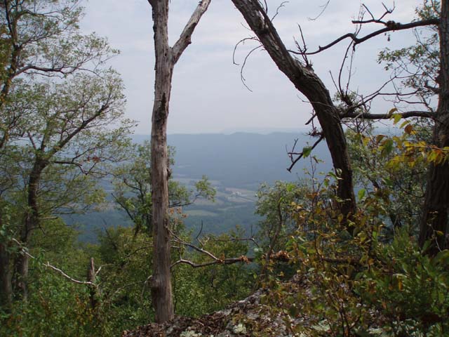
After taking in the view retrace your steps to the junction of the 2 jeep roads discussed earlier. For a change of pace skip the short side footpath and follow the primary jeep road all the way back to the white blazed Geyer Tr. (This is the first trail you passed on the way up.) Turn left here and descend to Aughwick Rd. Cross and pickup the white blazed Cameron Tr. Soon arrive at the red blazed Plessinger Tr. Turn right and follow the trail to its northern terminus on the Lakeside Road. Turn left onto the road and cross Aughwick Creek on a bridge. Bear left onto a gated gravel road. This is the Knobsville Rd Tr. It will soon split. The left fork goes to a group campsite. You want to bear right. In 0.28 miles pass an old logging road on the right (This also crosses your route near the end of the hike.) and then another on the left. Just above this is a bench and plaque describing a landslide that occurred at this location in the �90s. There is not much to see anymore from the bottom except a lot of new growth trees. The power and devastation of the event are a lot more obvious from the top. Continue up the road and soon come to the ruins of the old CCC camp incinerator. The road makes a sharp right turn here. Follow it. In another 0.43 miles come to a wooden deck that looks over the lake. The vista is not as grand as it used to be as the surrounding foliage is constantly encroaching. You�ll soon reach a high point on the road (not the ridge) and a turn around area. There will be a white blaze on a tree to the right. Ignore it and begin descending on the road behind the ridge. In about 0.35 miles from the lake vista come to the last overlook of the hike. It�s a pleasant pastoral view to the west. In another 0.30 miles arrive at a forest gate and sign for the white blazed Horseshoe Tr. There is also a sign warning of the trail's steepness. Turn right onto the footpath and climb, nose to toes, to the top. Take your time. The distance is only a bit more than 0.1 miles but you�ll ascend about 200 feet in that short distance. You might want to take a break at the top. From here you�ll descend at an equally steep rate but for about 0.4 miles. As you near the valley floor you�ll cross a logging road that you passed on your earlier ascent. At the bottom arrive at the junction with the Tuscarora Tr. Turn right onto it. Pass a campground road on the right and then cross the spillway on a bridge. Follow the trail and then an asphalt path around the lake for 0.53 miles until you arrive back at the bathrooms. If you are hiking there in season the concession stand at the beach sells all kinds of good stuff � including soft ice cream! Printable/Downloadable Directions and Trail Notes ______________________________________
______________________________________
Name: Alex
Outing
Critique: The Tuscarora trail was very overgrown, like
the last few people have mentioned. Up to Geyer Trail you're in
the forest, and at times it there was so much cover it was
difficult to follow the trail. At Geyer it opens up into the
jeep road, which isn't much better - easier to navigate, but
covered in knee-high grass. I went while there was still dew on
the ground and my boots were soaked in minutes. Poles and long
pants are an absolute must. M.R. Hyker Note: The Geyer Tr is now open. ______________________________________
Name: Fy
Outing Critique:
My wife an I took a hike on Friday 06/12/2015. The first part of
the trail was ok, you need to be in good shape to climb the
trail to the top. It has twists and turns and is very rocky.
Once at the top we took a brief rest on one of the overlook
areas. As we continued the trail was rather dangerous as the
path was overgrown with greenery and foliage we almost fell
several times twisted our ankle on a rock and cut my leg on a
tree stump sticking out. The reason for this is because it was
so overgrown we could not see our feet and where we were
stepping. It felt like we were in the middle of a jungle. We did
not want to get lost so we had to turn around and come back.
never made it to the Geyser trail, because we could not find it
.
Name: GB
Hike: Cowans Gap SP - Tuscarora Tr ______________________________________
Name: Doug Metzler
Hike: Cowans Gap SP - Tuscarora Tr ______________________________________
Name: Joseph Dooley
Hike: Cowans Gap Loop ______________________________________
Name: Shari
Hike: Cowan's Gap-Tuscarora Trail ______________________________________
Name: John S
Hike: Cowans Gap SP - Tuscarora Trail ______________________________________
Name: Mike Stinefelt
Hike:
Cowans Gap SP - Tuscarora Trail ______________________________________ |
|
|