
|
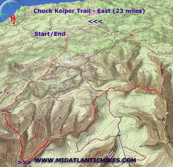
Chuck Keiper Trail - East |
|
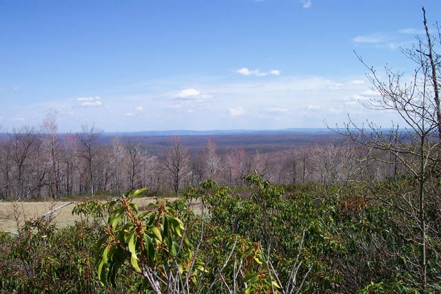
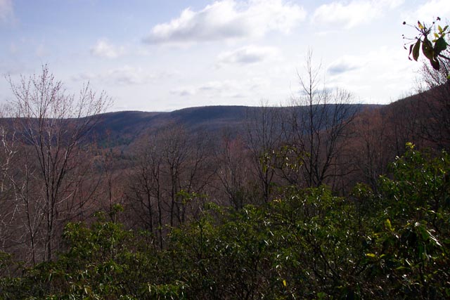
Notes: Special thanks to Scott Adams of WWW.PAHikes.com for scouting the Cranberry Run Campsite and providing us with travel directions and to Jeff Mitchell, author of �Backpacking Pennsylvania - 37 great hikes� for his thorough discussion of Boggs Hollow. Description: This trail, located in the Sproul State Forest, PA, is named after Charles Keiper, a dedicated conservationist and wildlife law enforcement officer. The entire loop is 52 miles in length but can be divided into a 33 mile western and a 23 mile eastern loop. The eastern loop is described here. While not quite as scenic as the Black Forest Trail the CKT is still a quality trail with a variety of environs including hardwood forests, highland bogs and swamps, Hemlock glens with pretty streams coursing through them and nearly bald plateaus created by the ravages of man (fire and logging). The tread is a mixture of footpaths and old logging roads. If you are in good shape and get an early start this loop can be completed in 2 days. Since I have to drive 5 hours to get to this venue I�ll approach it as a 3 day outing with the following daily mileages: 7.5 + 2.0 miles around Cranberry Swamp w/o packs, 7.0 � 8.5 and 8.0 � 6.5 miles, respectively. Alternate campsites are marked on the map should you decide to do this in 2 days or otherwise alter your mileages. |
|
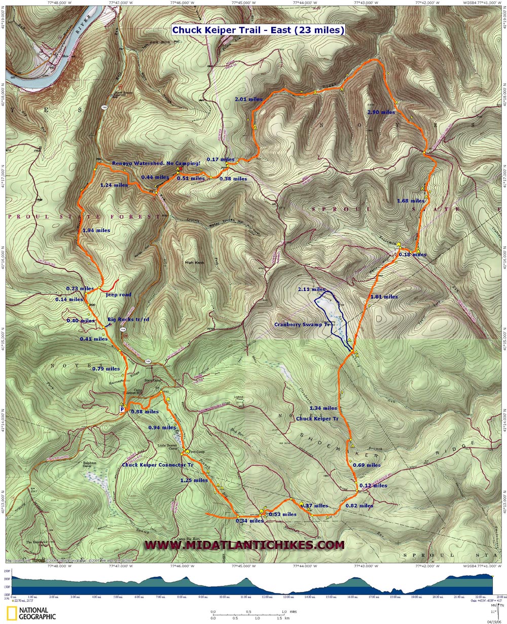
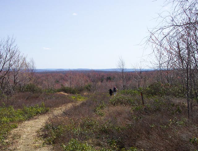
Be prepared for a good workout. There are three or 4 long, gradual climbs, each accompanied by its own steep and rapid knee jarring descent on the other side. Furthermore, at the end of each climb up a scenic hollow is a very steep climb waiting for you in order to cross a saddle into the next hollow. Overall, the total elevation gain is about 3600 feet, 2200 of it is from climbing out of Boggs and Drake Hollow on the last day. Although the hills in both directions had a big impact on me the part that I found the most tiring was the sidehill trails in Boggs and Diamond Back Hollows. At times the trail barely holds on to the hill. At other times it was non-existent. Luckily the blazes were there to show the way over an imaginary path. Google Custom Directions The hike starts at the Fish Dam Run View. _____________________________________ |
|
Zipped National Geographic. TOPO! GPS and Universal GPX Files |
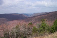
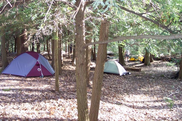
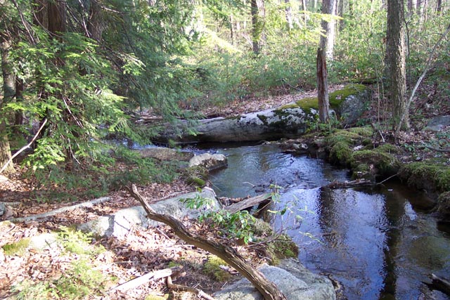
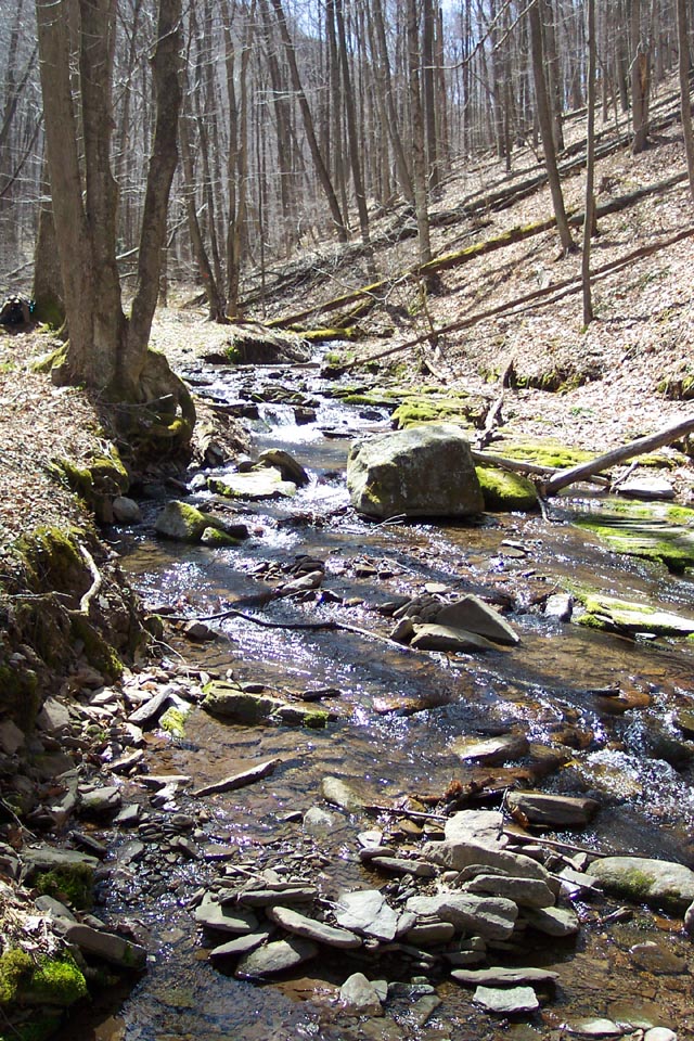
Trail Notes: Day 1: From the parking lot walk down the drive and cross Rt144. Begin walking up Swamp Branch Road but immediately turn left through a small spoil area to pick up the orange blazed connector trail. The trail roughly parallels the road using both footpath and old woods roads. Beware! At one point the trail abruptly leaves a woods road on a footpath to the left. Someone placed orange flagging further down the woods road where it disintegrates in a field. This in not the way! In about 0.88 miles the trail comes out onto a parking area next to the road. Turn right onto a driveway and soon pass a cabin on the left. The trail passes an interesting bog with views to the west. In 0.94 miles turn right onto a gravel road and cross the east branch of Big Run. Immediately turn left off of the road after crossing the stream. You�ll pass another cabin along the way. Continue to follow the Big Run Drainage for 1.25 miles. There are at least 3 good campsites along this segment. The first is large but appears to be dry. If you climb up on the short hill behind it you�ll find you are only yards away from the stream. At the end of this last segment join the Chuck Keiper Tr. Turn left and in 0.34 miles cross another road, passing a cabin and seasonal stream as you go. In another 0.53 miles turn right onto another road and then left onto a footpath. Cross Rock Run with campsite potential (No fire rings found.). There is a cabin further upstream. Climb steadily for 0.82 miles to the top of Shoemaker Ridge and cross another road. Descend into a small tributary. Another road comes in from the left in about 0.1 miles from the last road crossing. |
|
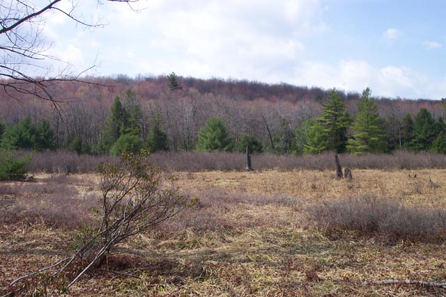
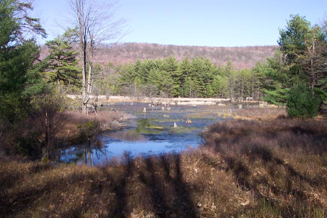
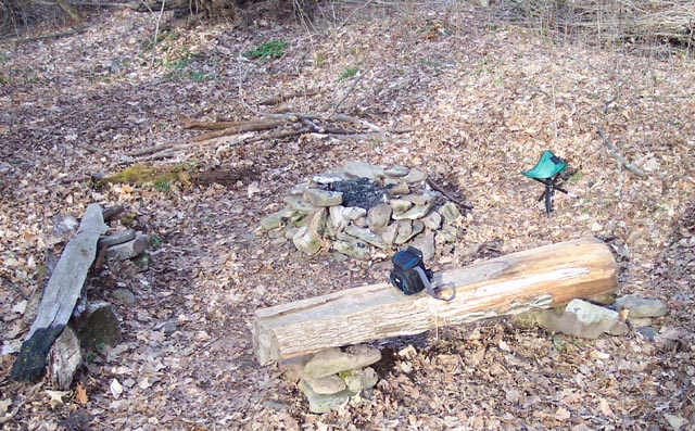
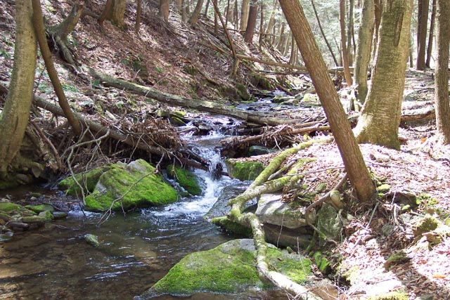
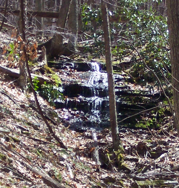
Continue straight, cross a small stream and climb to the top of another small portion of Shoemaker Ridge.Descend steeply to Clendenin Run (about 0.69 miles from the last stream crossing). Potential campsites are downstream. The next 1.34 miles features another patented CKT gradual ascent w/steep descent into the Cranberry Run Drainage, my choice for a campsite if doing the trek over 3 days. Cross a well-constructed bridge and turn right along an old RR grade, leaving the CKT. There is a fire ring and room for several tents nestled in the shade of a Hemlock Grove. Should the site be taken there is another smaller one along the Cranberry Swamp loop on the east bank not far from its junction with the CKT. I highly recommend walking the Cranberry Swamp Loop (Blue blazes) after setting up camp, should time and conditions allow. If you are continuing on to another campsite consider stashing your packs and taking the walk before moving on. If you are quiet you might see some Mallards and/or Wood Ducks. There are 3 main viewing areas where the trail gets close enough for you to take it all in. Day 2: Continue north on the CKT. Almost immediately you�ll start another gradual climb. This one has a more gradual descent following it as it joins an active woods road. You�ll pass another woods road on the left and at 1.01 miles from your Cranberry Run Camp the road makes a sharp right turn. (At the turn, across the road, there is a bridge that crosses Benjamin Run. If you peer up into the trees you can see a cabin to the left on a hill.) Make this right turn and follow the road and stream through a thick evergreen forest, Hemlocks to the left and along the stream and pines to the right up on a slight hill. This looks like a good place to camp should you get in a bind but there are no fire rings. In 0.18 miles turn left, crossing a bridge over Benjamin Run and passing yet another cabin on the right. You�ll see a neat little spigot in a box supplying water from a spring to the left. Begin a steady climb up Sled Road Hollow. The stream is particularly pretty and flows through Hemlocks in several places. Near the upper end of the stream are some nice campsites, one with a fire ring. This would be a good place to camp if you are doing the circuit in 2 days. It is pretty near the halfway point. As you leave the drainage you�ll join an old woods road that climbs steeply out of the hollow. At 1.68 miles from leaving Benjamin Run and the last cabin cross Mill Run Road and begin a very steep descent down a branch of Boggs Run Hollow. About 1 mile down, where water begins to flow in this branch, there is a small campsite. Continue on. In about another mile the trail makes a hard left and follows the main branch up the hollow. There is a small, seldom used campsite amongst Hemlocks at the next side branch, after you cross the stream and to the right. Continuing on you�ll cross another branch and then descend to the main stream. This is a pretty good campsite and marks 7.0 miles of your second of 3 days. You can camp here or if stamina, weather and time allow, cross the stream and continue about another 1.3 miles up the hollow. Shortly after the trail joins a railroad grade there will be 2 campsites to the left, both under Hemlocks. We didn�t see (or look for) a fire ring in the first but there were 3 logs arranged in a pattern suggesting that this was/is used as a campsite. The next one, just a few yards further along, has a fire ring. Day 3: Continue up Boggs Run Hollow. The RR grade will cross the stream near its headwaters and soon become a footpath. After 2.01 miles from the lower camp/stream crossing, climb steeply out of the remainder of the Hollow and cross a pipeline/power line swath. In 0.17 miles arrive at gravel Pete�s Rd. Turn left onto Pete�s Road. In a few yards turn right onto another forest road. Pass a dry campsite (probably used by hunters). In 0.38 miles from Pete�s Rd. come to a Renovo Watershed sign (No camping in Diamond Back Hollow). Leave the road to the right and pick up a footpath. Descend steeply through Hemlocks and follow an old, rocky streambed for 0.51 miles to a stream junction and illegal campsite. Continue downstream for 0.44 miles on a sidehill trail that at times comes seriously close to the steep bank. Cross Hall Run and climb up to the road. Cross the road and climb via a switchback to a nice segment of sidehill trail. Follow this to Drakes Run (approximately 1.24 miles) where the trail will turn left, up Drakes Run Hollow. The trail will climb a little before switching back and descending on a set of rock stairs to a pretty scene along the stream. Cross the stream and turn left onto a railroad grade. There is a campsite close by. This is the last �wet� site that I can remember on this loop. Here the RR grade starts a slow but steady climb for about 1.94 miles up the hollow. It crosses the stream early on. Near the top the RR grade jumps over to the other side of the hollow and changes direction. You want to continue up the hollow on the blazed trail. There is a part time waterfall to the left as you climb. Closer to the end of the hollow the trail will turn right and roughly follow a part time rocky stream up to the next saddle. You are now finished with all of the serious elevation changes and rough trails! Arrive at an old grassy/mossy jeep road. Turn right and follow it 0.23 miles to its junction with Ben�s Ridge Road. Turn left and follow this active woods road. In 0.14 miles another road comes in sharply from the right. Stay straight. In another 0.4 miles there is a blue blazed Big Rocks Road/Tr to the left that leads to an interesting rock formation and perhaps some views. We�ve not explored it. Continue on Ben�s Ridge Road. In another 0.41 miles bear right onto an old grassy jeep road that is quickly becoming a trail and cross over an earthen bearm. Follow this trail through a forest fire area for 0.74 miles back to your cars. Printable/Downloadable Directions and Trail Notes _____________________________________
_____________________________________
Name: Matthew Outing Critique: This was a great hike. My wife and I left the parking area and hiked counter clockwise. We saw many bear scats, but no bears. Somehow we missed the Cranberry Swamp trail, and ended up hiking all the way to the Boggs Run area on day one. The trail was well maintained, with the exception of some blowdown which is to be expected in this area. If you do this hike, wear pants! There are a lot of nettles in the Boggs Run area and a few other places as well. Lots of uphill jaunts, and very steep downhills. We didn't see many proper views, but what this hike lacked in views, it make up for in extremely pretty tall tree canopies, and solitude. We saw two hikers over our two days in the woods. Please watch out for yellow jackets in the Boggs Run area though! They are very prevalent. The campsite(s) in Boggs Run were nice, albeit damp. Very nice hike though. Can't wait to finish up the West Loop! _____________________________________
Name: SlugMaster Garret Hike: Chuck Keiper trail-East and West Date: 05/22-25/13 Rating: 4
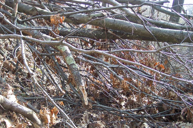
Critique: We did the east loop from the Fish Dam Vista parking lot and heading clockwise towards the northeast. The trail was well blazed and easy to follow. Ticks were particularly numerous in Drake Hollow. There are a few downed trees across the trail between Hall Run and the top of Diamond Rock Hollow that require going off trail. A trail maintainer with a chainsaw would be useful in this area to clear the path. Other than these obstacles the trail was a pleasant walk. We started around 2:00pm on Day 1 and reached the Connector trail around 2:00 on Day 2. I agree with the previous poster that this trail can be done in 24 hours if you move at a decent pace and start the hike early in the day. My group decided to continue forward onto the West Loop at this point and continue rather than take the connector back to the car.
_____________________________________
:Name: Ed
Hike: Chuck Keiper Trail - East Loop _____________________________________
Name: Steve
Hike: Chuck Keiper-East Loop _____________________________________
Name: trail-god
Hike: Chuck Keiper Trail-East _____________________________________
Name: Matt Reeser
Hike: Chuck Keiper East Loop _____________________________________
Name: Ryan Alford Hike:
Chuck Keiper Tr - East _____________________________________ |
|
|