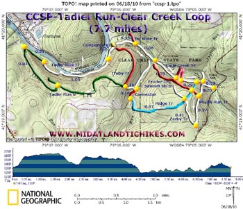
| Tadler Run-Clear Creek Loop |
|
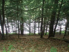
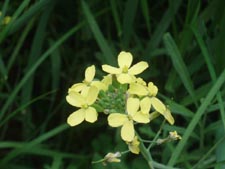
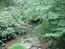
Description: Clear Creek State Park has recently been �Administratively� combined with Cook Forest State Park. While small at 1400 acres when compared to its big brother (8500 acres) It still offers the visitor 25 miles of seldom hiked trails and loads of solitude. While none of its forest has been spared from the lumberjack�s axe it supports a pretty nice hardwood forest on the plateau with Hemlocks, Rhododendron, Spruce and Red Pines on its slopes.
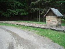
Described here is a moderate 7.7 mile circuit that circumnavigates the part of the park on the south side of Clear Creek. Google Maps Custom Driving Directions The hike starts just to the left of the Spring House in the back of the Shelter 5 parking area. |
|
________________________________________ |
Zipped National Geographic TOPO! GPS and Universal GPX Files |
Trail Notes: All of the trails are blazed. Those trails that are not part of this hike are shown as approximations and without regard to true blaze color (shown on the map as red).
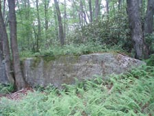
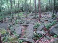
There is a large stone platform to the left of the spring house. Back in the woods at the far left corner of it you will find the Clear Creek Trailhead sign. Follow the faint white blazes for 0.18 miles and turn left onto the Phyllis Run Trail (also blazed white but with metal rectangles) and climb steeply for 0.20 miles to the junction with the Frazier Trail on the right. Follow the Phyllis Run trail for another 0.37 miles where it ends at the Zerby Trail (Also blazed with white metal rectangles). Turn right onto it and in 0.41 miles turn left onto the Ridge trail. It is blazed with blue metal triangles. In 0.97 miles it will go through a small rock field above Truby Run before ending at a Pipeline Swath.
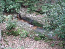
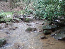
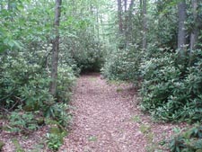
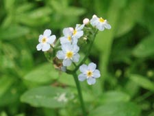
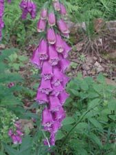
This next part is the only real tricky aspect of the route. Cross the pipeline and turn left, crossing a bridge. Walk about 10 yards up the pipeline and then turn right, bushwhacking through the woods a short distance. There you should find a trail with red and white disk blazes. Turn right onto it and follow it a short distance to a white paint blazed Ski trail. According to the park map it is the Sawmill Trail but the sign merely states �Ski�. Turn left here and climb steeply to a wide Grassy Road. To the right is the Truby Trail. Continue across the road to the green blazed Tadler Run Trail. For the next 1.14 miles enjoy some nice flat walking as the trail stays close to the edge of the ridge. You�ll pass a bench along the way that now marks an overgrown vista. After this distance there will be another bench with a trail in front of it blazed with green �Ls�. This used to lead to a vista but it is overgrown as well. From this point the trail descends on an old grade along its namesake through wonderful tunnels of Rhododendron. Look for beautiful bouquets of Forget-Me-Nots around the seeps you will cross. |
|
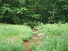
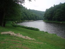
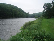
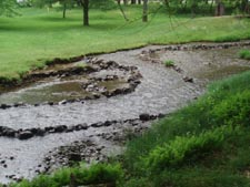
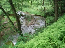
As the Clarion River comes into sight the trail will enter an evergreen grove where it turns abruptly right onto another old grade (0.84 Miles from the last bench). In 0.31 miles the trail leaves the grade to climb a footpath to yet another grade. During this climb the trail markings change from green and silver disks to white disks (though old green paint blazes can still be seen for the trail�s remainder). The trail stays high above the river for 1.05 miles until its end at the canoe campground. Here you will get great views of the Clarion (a National Scenic Waterway). Follow the main campground loop road to the right and turn right onto the Clear Creek Trail blazed with white paint. Initially it will be part of a gravel nature trail but in 0.33 miles the nature trail turns left onto the Ox Shoe Trail and the Clear Creek Trail becomes a dirt affair. In 0.36 miles the trail will cross the pipeline swath that bisects the park and climb away from the creek over 2 stages. At this elevation it will pass through a very dense Red Pine forest. Pass Little and Big Coon Trails on the left in 0.39 miles from the pipeline. You should also pass the junction of the blue blazed Ridge Trail on the right but I honestly don�t recall seeing a sign for it. In 0.29 miles from the Big Coon trail pass the junction of the Phyllis Run Trail that you used earlier and in 0.20 miles arrive back at the parking lot.
________________________________________
________________________________________ |
|
|