|
Blue Ridge Center for Environmental Stewardship 07/01/08 |
|
|
Description:
The 894-acre Blue Ridge Center property was purchased by the
Robert and Dee Leggett Foundation in 1999 to protect the AT from
encroachment by developers. It was donated to the B.R.C.E.S. in
2004. The Center includes a working community farm, open fields
and meadows and new and old growth forests. Through it all runs
a series of small interconnecting loop trails.
This trail
system is a combination of old woods roads and footpaths
featuring
old cabins
and homes,
ponds
and
wetlands, views of what I believe is
South
Mt, pretty streams and a ton of wildflowers. They include
but are not limited to:
White Avens, Deptford Pinks, Black-eyed Susans, Fleabane, Ox-eye
Daisies,
Foxglove Beardtongue, Scarlet Pimpernel, Venus Looking Glass,
Hyssop Skullcap, Tall Bellflower,
Butterfly-weed, Common Milkweed,
White Vervain and
Yarrow just to name a few. The site is also
home to Black Bear, Deer and an assortment of Butterflies. Bring
your field guide for this one! Described here is a 6.5 mile easy circuit with a few short hills with only one short section of trail that is used twice. To learn more about the B.R.C.E.S. visit their site. Google Maps Custom Driving Directions |
|
________________________________________ |
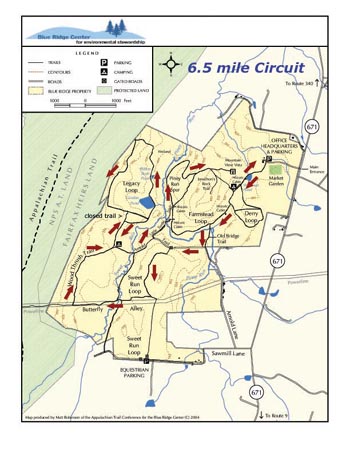
| Map courtesy of B.R.C.E.S.
|
Trail Notes: All trail junctions are signed. You may see an occasional red blaze but these are very intermittent. The Jonathan Rock Tr is blazed blue. There are approximately 8 interconnected loop trails at the center. Described here is a 6.5 mile circuit with minimal retracing of steps. GPS data or elevation data is not provided.
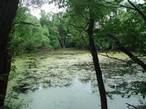
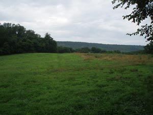
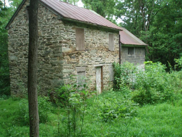
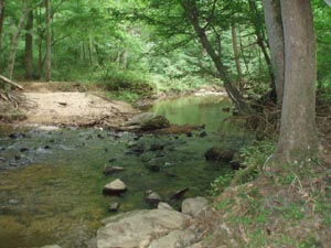
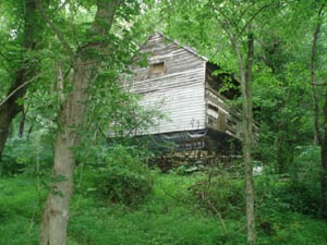
If facing the Kiosk at the main parking area turn left and follow the gravel road for 0.1 miles. Turn right at the "trails" sign. In another 0.16 miles pass a small pond w/bird viewing blind and a collapsed building on the left. In 0.20 miles pass an open field used for group camping on the right with a shelter, pavilion and a view of a mountain. Immediately after the camp come to the junction with the Farmstead Loop Trail (left and right). Bear left (the trail to the right is your return route) and in less than 0.1 miles pass an old stone house on the left. In 0.2 miles turn left onto the Old Bridge Tr. Ford Piney Run just below a small island and in 0.17 miles reach Arnold Lane (a gravel road).
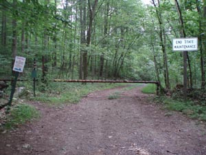
Turn right onto Arnold Lane and follow it to a gate in 0.25 miles. Turn left onto a footpath - Sweet Run Loop Tr. Climb up and over a low lying knob and in 0.46 miles arrive at a power line swath referred to as Butterfly Alley. Turn right an follow the swath uphill for 0.55 miles passing sections of the Sweet Run Loop trail on both the left and right as you cross that stream. Turn right onto Wood Thrush Tr. In another 0.55 miles arrive at a grassy opening in the woods and a nice campsite. To the right is the continuation of Arnold Lane/Trail. You'll use this later. For now bear to the left following the signs to Gordon Pond.
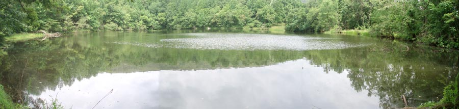
In 0.18 miles arrive at another sign. The trail straight ahead has been closed. Turn right to continue to Gordon Pond. In 0.2 miles pass another trail junction on the left. (You will come down from there later.) |
|
There is an old road to the right that has be abandoned. Ignore it. Continue to follow the signs to Gordon Pond. This is a nice break spot. For some reason fishing is not allowed here. After you cross the dam of the pond you'll pass a smaller one hidden in the trees to the right. Shortly after that the trail turns left and climbs uphill a bit before turning left onto what was once an old road. In 0.92 miles from the pond pass the other end of the "closed" trail you passed later and descend to the last trail junction you encountered. Turn right and retrace your steps to the clearing and junction with Arnold Lane/Trail.
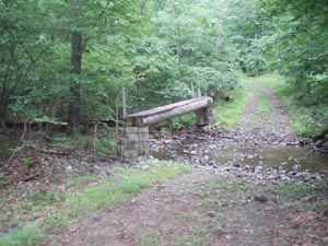
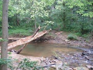
Turn left onto Arnold Lane/Trail. In 0.12 miles cross Sweet Run (The bridge usually isn't necessary.) and pass a segment of the Sweet Run Loop Tr on the right. In another 0.19 miles turn left onto the Little Turtle Trail. In another 0.15 miles there is an unmarked trail junction. We believe that straight ahead was the original ford of Piney Run. The trail to the right also crosses Piney Run at a fordable spot but a new bridge is being constructed here. (It looks like the crew is having some issues.) Use this ford. The Farmstead Loop Trail is to the right and straight ahead. Here you can see the main house from the original farm. Either way will get take you back to your vehicle but turning left behind a wooden woods gate will prolong the hike. Turn left past the gate and soon join Piney Run Spur. The trail will parallel Piney Run for a while on an old woods road. Old USGS maps and the current state of the area around the stream (wetlands) suggest that at one time there was a man-made lake here.
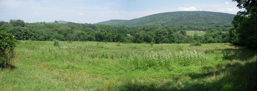
Shortly after passing what appears to be an old quarry, mining area or borrow pit (perhaps for the original dam) on the left the trail bears right and switchbacks to the top of another low knob. In 0.57 miles from the last trail junction turn left onto the continuation of the Farmstead Loop Trail. In 0.13 miles arrive at the Mountain View Vista Spur on the left. Follow it out to a nice view of the farm and surrounding mountains. Return to the Farmstead Loop Trail and turn left. Soon pass (Jonathan's) Rock Tr on the right. Descend and in 0.15 miles arrive at the trailhead for the Farmstead Loop Trail. Turn left and retrace your initial steps back to your vehicle.
________________________________________ More Photos
________________________________________ Outing Critiques
Name: Ed. S
Hike: Blue Ridge Center for Environmental Stewardship _______________________________________ |
|
|