| Blue Knob State Park |
|
Description:
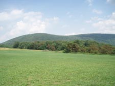
Blue Knob SP's number one claim to fame is having the second
highest point in PA (A ski resort). It is also known by most
hikers as having the northern terminus of the Lost Turkey trail
inside its boundaries. What it is not known for is its
under-rated and underutilized trail system that, for the most
part, takes the hiker through mature hardwood forest and a
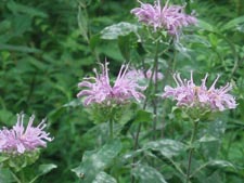
pretty glen full of Hemlocks and Rhododendron. The trails are
well maintained and blazed with different colors/shapes and all
but one or two intersections are signed. "Most" elevation
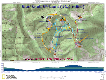
changes are pretty gradual. Described here is a 10.4 moderate
circuit with almost 2000 feet in elevation gain that emphasizes
the key parts of the park. The outing can be shortened or
lengthened. (Obtain a park map for the latter since all trails
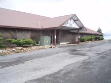
are not shown here.) Google Maps Custom Driving Directions The hike starts at the Chapples Field parking area. |
|
________________________________________ |
Zipped National Geographic TOPO! GPS and Universal GPX Files |
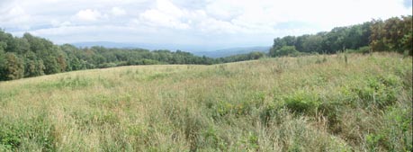
Trail Notes: From the parking area, as you look at the mountain in front of you, turn right and walk across the grass through the trees to a panoramic view towards the town of Bedford. Turn left on a well worn spur trail and then right onto the Chappels Field Trail (Blazed with inverted orange Vs.), an old woods road at this point. In 0.32 miles the road splits. Bear right, uphill a bit and then turn left onto the orange blazed Crist Ridge Trail. In 0.82 miles turn left onto the park road for a few yards and then right back into the woods, passing a small clearing with a partial view. Initially the descent is very gradual, then it switchbacks abruptly to the left to descend to the park road on another old grade.
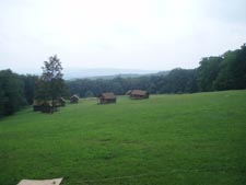
Turn right onto the park road and then left onto the blue blazed Rock N' Ridge trail. In 0.43 miles the trail descends to Pavia Run. A spur from a picnic area and swimming pool comes in on the left. Turn right and follow the stream through Hemlock trees and Rhododendron thickets. In 0.54 miles from the last junction bear right at a fork in the trail (bearing left would eventually lead you back to your starting point.) In another 0.76 miles the trail makes a right hand turn to eventually join up with the "ridge" portion of this loop trail. To visit Camp #1 and its views, turn left instead. Besides a nice view beyond the cabins you will find water and bathrooms. Follow the gravel road behind the main lodge and basketball court. Make a sharp right turn onto the Sawmill Trail (An old woods road) at a water storage tower. The park brochure says that the trail is blazed yellow but you will find mostly orange markers. |
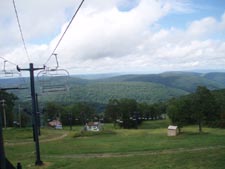
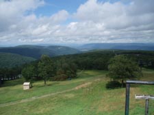
|
Another 0.5 miles finds you passing the final junction with the Rock N' Ridge Trail on the right. In 0.84 miles the Sawmill Trail ends. Turn left onto the red blazed Mountain View Trail. In 0.23 miles arrive at a tool shed and the junction with the Three Springs Trail straight ahead. Turn left to stay on the Mountain View Trail. In 0.32 more miles the trail splits with a blue blazed connector trail straight ahead. (You'll use this later.) Bear right and climb steeply for 0.84 miles to the Tower Road. Bear right on the road and walk 0.28 miles to the ski lodge and views from the top of the slopes behind it. Try to blank out all of the ski lifts as you take in the view of distant ridges! Retrace your steps back to the blue blazed connector trail mentioned earlier and turn right onto it. This is a narrow rocky footpath that parallels the Sawmill Trail for 1.05 miles until it finally joins it at the old water tower. Obliquely cross the gravel road to join the rest of the Sawmill Trail and follow it for 0.5 miles to the park road. Without crossing the road bear left onto Chappels Field trail and follow it back to the first spur trail you used in the morning. Turn right to get back to your vehicle. ________________________________________
________________________________________ |
|
|