| Fallen Timber trail-Mid State Trail Loop |
|
|
Description: Bald Eagle (Named after a native American who lived there.) State Forest stretches across Pennsylvania with Rothrock State Forest as its southern boundary and Tiadaghton State Forest as its northern boundary. Together they form the longest stretch of continuous protected forest in Penn�s woods. Nearly two thirds of the Mid-State Trail (MST) courses through them. While the MST was constructed primarily as a linear trail loops can be formed with sections of it, especially near and around state parks.
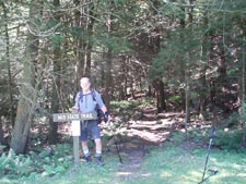
Described here is a 11.79 mile trek with 100 feet of elevation gain starting at Raymond B. Winter State Park. It can either be done as a long day hike or nice overnight backpack. It can also be added to form a multi-day figure 8 backpack by combining it with the Mid State trail-Old tram Trail Loop. If backpacking the park requests that you park at Park Headquarters and complete the registration form found in the vestibule. Google Maps Custom Driving Directions The hike starts on Rt192 at the dam parking area. The Mid State Trail is part of the Great Eastern Trail (GET).
|
|
________________________________________ |
Zipped National Geographic TOPO! GPS and Universal GPX Files |
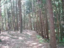
Trail Notes: From the parking area cross the road and walk down towards the bridge over Roaring Run. Bear right onto the MST in a grassy area. Descend for 0.20 miles to the junction with the Brush Hollow Tr, Turn left and hike back to the road. Turn right onto it for 0.11 miles. Turn right onto a recently constructed snowmobile trail. The trail will parallel the road for a bit before crossing Roaring Run on a bridge. In 0.42 miles turn right onto gravel Pine Creek Road. In 0.65 miles, as the road turns sharply to the left, continue straight past the forest gate onto the red blazed Fallen Timber Trail, an old haul road that climbs gradually to the top of Shriner Mountain. At 1.09 miles from leaving Pine Creek Road pass the overgrown blue blazed Panther Run Tr on the left. In another 0.32 miles cross the intersection with the Yankee Run Trail. (To abbreviate the hike turn right here and then right onto the MST. In 1.42 more miles the Douhty Mill Tr jogs across your path. This is your last chance to truncate the hike.
As the trail flattens out and then begins a gradual descent you will encounter several areas wear loose rock was placed in low spots in the trail to aid logging equipment. In 1.84 miles from the last trail intersection the Fallen Timber Trail ends with the MST continuing straight and to the right. Turn right onto the footpath and in 0.16 miles arrive at Stover Gap Road. The most reliable water source on this hike is across the road. Between it and a hunter�s cottage find Horse Path Spring and a deep rock cistern. It had plenty of water during an extreme August dry spell. Continue down the road until it switchbacks hard to the left. Continue straight into the woods on the MST/Brush Hollow Trail. |
|
In 0.29 miles reach an old grassy logging road. To the right is a nice campsite on another haul road. Pass a Sphagnum Peat bog on the right with a potential spring on the right in another 0.65 miles. In 0.47 cross the Doughty Mill Trail again and in 0.61 miles pass the Oley Camp Trail on the left. In another 0.5 miles pass one of the few open areas in the forest floor � a potential dry campsite. (Water is just a bit further down the trail.) Cross 0.15 miles cross the Yankee Run trail again. A built up trailside spring will be on the left in 0.15 more miles. In 0.34 miles pass another bog/spring on the left. The Long Path will come in from the left in another 0.15 miles. Stay on the MST. Here the descent increases as you start to enter wonderful Brush Hollow again. In 0.61 miles pass the blue blazed West Boundary trail. In another 0.58 miles arrive back at the junction with the Brush Hollow trail. Turn left and hike back through the gorge to your vehicle.
________________________________________
________________________________________
Name: Doug McKenzie Hike: Fallen Timber-MST Loop Date: 04/12/15 Rating: 4
Critique: Nice
long loop. Took 5 hrs. A bit rocky walking, especially on the
first half of the Mid-State on the way back. Not sure of the
directions at very end, i.e. LT onto Brush Hollow Tr. I
followed the MST and came out at the dam. All in all, a very
nice outing, all the trails in good condition with plenty of
blazes. ________________________________________
Name: R, B & J
Hike: Fallen Timber/MST Loop ________________________________________ |
|
|