| 1,000 Steps/Standing Stone Trail Out-and-Back |
|
|
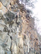
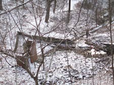
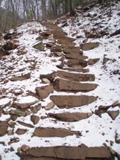
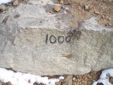
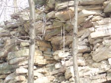
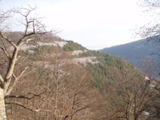
Description: The Standing Stone Trail (SST, formerly the Link Trail) is a 70+ mile long connector between the Tuscarora Trail in Cowans Gap State Park and the Greenwood Furnace Spur of the Mid-State Trail at Greenwood Furnace State Park. Much of it traverses the ridges of several State Game Lands. A section of special note is where the SST climbs and descends Jacks Mountain in SGL 112 between the towns of Mount Union and Mapleton Depot. This area is commonly referred to as Jacks Narrows. From the late 1880s to the mid 1950s the main industry of this area was brick making. The rocks used were quarried directly from the face of Jacks Mountain. Initially workers would ride the Dinkey trains to reach their job sites. They lost their rides in the �30s when the company switched from trains to trucks. Already experts at busting rock the workers proceeded to build steps into the side of the mountain to ease their new pedestrian commute. By the time they were finished they had laid over 1,000 of them. They still exist today. This 800 foot change in elevation over a mere 0.4 miles was made part of the SST. |
|
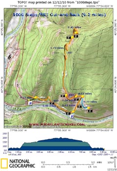
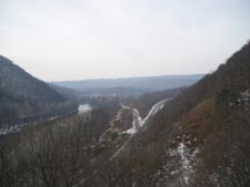
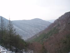
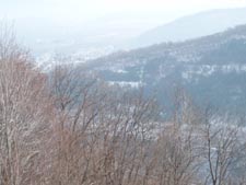
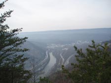
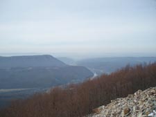
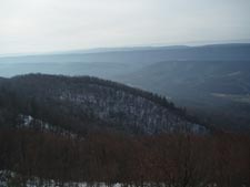
While it is possible to �do the steps� as a round trip in less than a mile we�ve added extra mileage before and after it to form a 9 mile out-and-back with 2200 feet of elevation gain visiting several wonderful vistas, most of which were created by the quarry operation. Since it is a linear hike you can shorten (or lengthen it) to fit your needs. There is one more vista about a mile beyond the last one noted here but the shortness of the winter day prevented us from exploring it. Google Maps Custom Driving Directions The hike begins at a small unmarked pull over just west of a Texaco Gas Station on U.S. 22. Parking is no longer allowed at the large/empty Motel 22 lot a � mile farther west. The Standing Stone Trail is part of the Great Eastern Trail (GET). ________________________________________ |
Zipped National Geographic TOPO! GPS and Universal GPX Files |
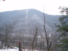
Trail Notes: From the parking area follow a wide grassy road for 0.15 miles to its junction with the orange blazed SST. Turn right onto it. Walk on a nearly level Dinkey (narrow gauge railroad) grade for 0.98 miles passing several vistas and rock cliffs along the way. Turn left at the kiosk to begin the ascent of the 1,000 steps. You will find several landings (sections of old Dinkey grades) along the way where you can catch your breath and check out the views. In 0.41 miles reach the top of the steps. Turn right onto a blue blazed trail/grade and in 0.33 miles reach the Mount Union Incline vista. (An incline was a steep railroad grade too steep for trains. An engine at the top would lower cars full of rocks (or other product) down the grade using pulleys and cables to awaiting transportation that took them to the brick plants.) After taking in the view retrace your path, passing the steps. In another 0.13 miles arrive at the Dinkey House (a maintenance building for the locomotives). The trail ascends steeply behind it to yet another grade. Turn left onto it and in 0.34 miles (the sign says 0.5) arrive at a vista with a view west toward Mapleton Depot. The trail continues to climb quite gradually (barely perceivable) for the next 1.72 miles to another vista. While nice we urge the traveler to continue 0.40 miles farther along more switchbacks to the top of a large rock pile. Here you will be rewarded with a 180 degree view from Mapleton Depot to the south to Mill Creek to the north. As noted in the description there in one more vista near the very top of the mountain (about a mile from the last). If time allows consider visiting it before turning around and retracing your steps back to your vehicle.
|
|
|